

Letter from Ammanford
Pamela Jones
If I was a time traveller from the 1800s I would know Ammanford as Cross Inn in the parish of Llandybie. The parish extended from the Cennen River at Derwydd to the River Amman which formed the border with the parish of Betws.
The hamlet itself was situated at the convergence of two important routes and the coaching inn which serviced the travellers became known as the Cross Inn, which in turn gave its name to the hamlet.
Confusingly, there were two Cross Inns on the square in Ammanford – one still exists (known as the Old Cross Inn) and the other was demolished in the 1960’s together with another two public houses, the New Inn and Castle Inn.
Due to the rapid industrialisation of the area in the 19th century and the fact that there were other Cross Inns in the locality it was decided by a committee in November 1880 that the village should be known as Ammanford.
Ammanford Castle
The 12th century motte and bailey castle (a wooden tower/keep) lies on the site of Cartref in Tirydail. Only the mound and part of the surrounding ditch now exist.
There is no documentary evidence to suggest the original builders but based on its date and strategic position it may be one connected with the Lord Rhys, Rhys ap Gruffydd, lord of Deheubarth (a large medieval kingdom consisting of the west and south west of Wales).
For as the poet R.S.Thomas put it “In Wales the past is always present.”
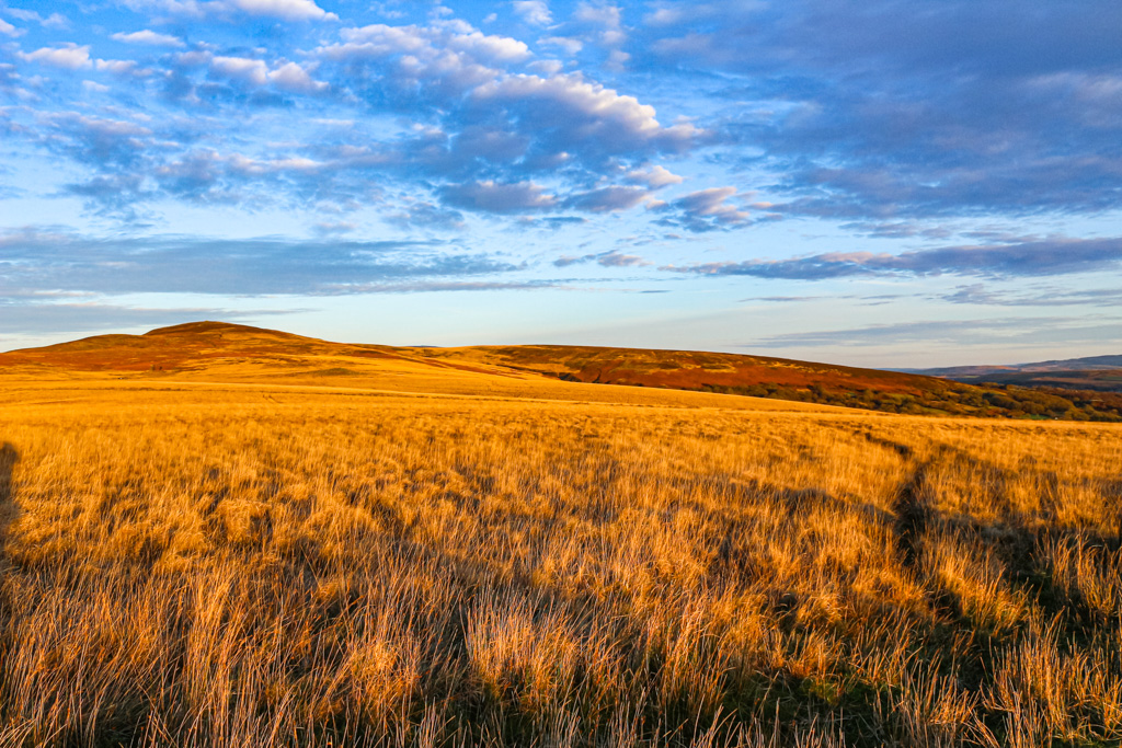
Tair Carn Mynydd Du/Black Mountain
Back in the 1980s I was reading our local newspaper when I saw an article by Ramblers Cymru about a walk to Tair Carn Isaf on the Black Mountain/Y Mynydd Du.
I decided to find out more about this exciting new walk but, on doing a bit of research, the penny suddenly dropped – and I realised that it was, in fact known by the locals as the Turcan.
By a happy coincidence a few months later I was fortunate enough to start working for the Welsh Officer of the Ramblers who lived locally.
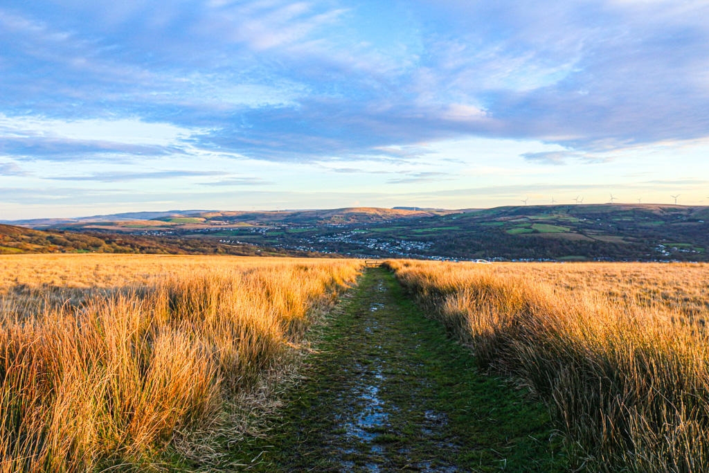
The relatively easy walk from the parking area up to Tair Carn Isaf is very rewarding. There are magnificent views in all directions (on a clear day) – with Cwmamman to the south while the sea can be seen gleaming in the distance at the Loughor Estuary as well as the conical shape of Frenni Fawr and the Preselis in the opposite direction.
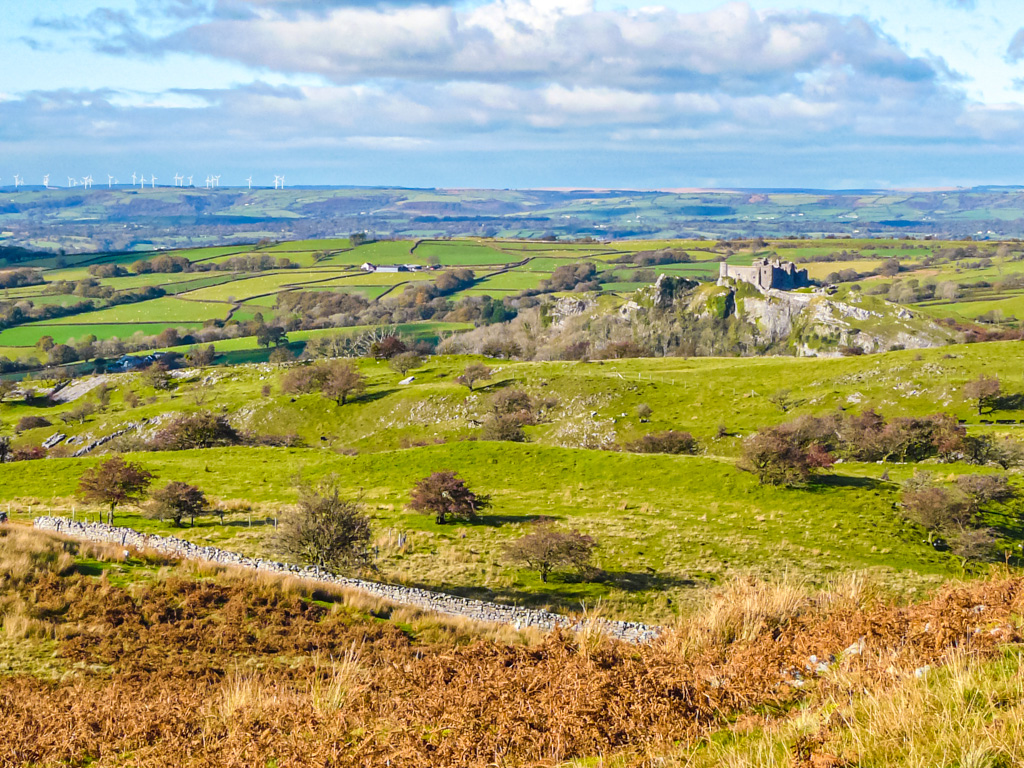
To the north stands Carreg Cennen castle and the brackeny ridges of the Carmarthenshire Vans.
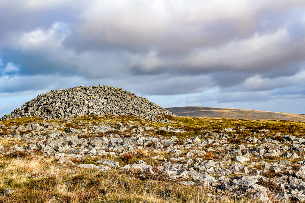
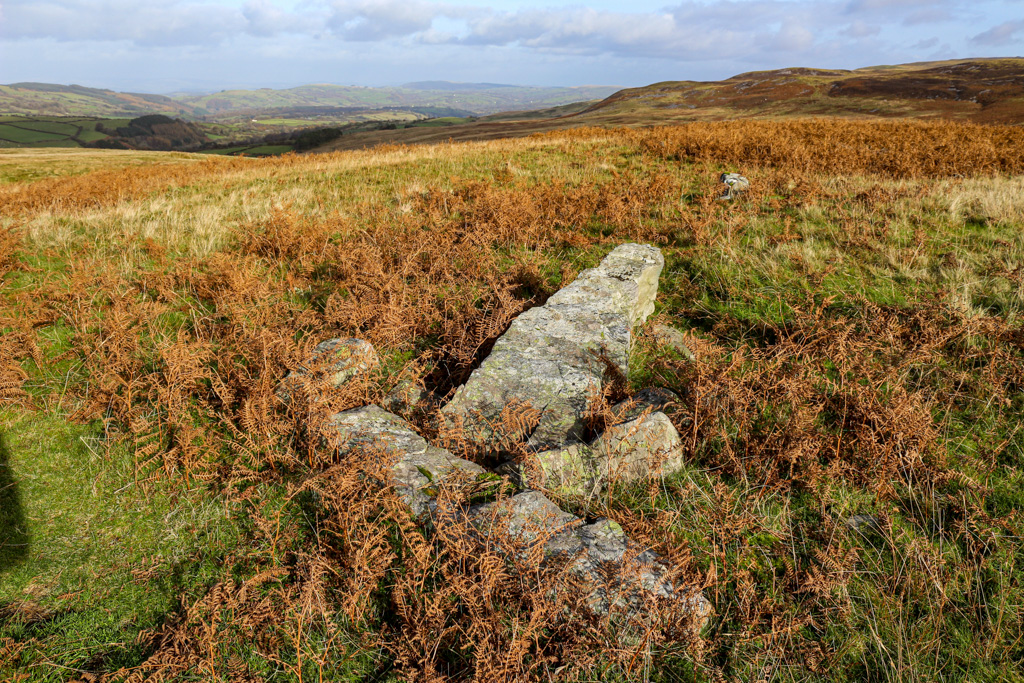
Territorial markers
As the place name tells us – there are three cairns on Tair Carn Isaf and a further three cairns at Tair Carn Uchaf.
Our ancestors who lived in the Bronze Age 4000 years ago cremated their dead and interred them in the ground and a cairn was constructed over the top or cists (stone boxes) were inserted into the cairn.
Wales has a vast number of these which are usually sited on a high vantage point which suggests that round cairns may have been important territorial markers…
Standing Stones/Menhir were also erected at this time although their function is not understood: it is clear that their construction would require considerable effort and so would have been highly important to the people who used them. They may also have had a ritual function or served as markers of route ways within the landscape.
Some sites have burials associated with them others appear to align to the location of the sun or moon at solstices and equinoxes.
Pen-y-Coed standing stone to the west of Tair Carn Isaf marks the interface between enclosed land and open common and is also the parish boundary.
Memories
My dear late father told me tales of when he was in the Home Guard which was based in the Drill Hall, Garnant in WW2 and they would march up the hill from Tirycoed Road in Glanamman up to Brownhill with rifles on their shoulders but without any ammunition!
He spoke of one man who was tired of doing the march and “borrowed” a pony from a field to ride up but his ploy was quickly spotted and there was an almighty row!
Dad also spoke about the Americans who were based in the huts at Pal y Cwrt near Carreg Cennen Castle and who visited the dance hall at the “Palais de Danse” (later, more prosaically, The Haig Hall) in Garnant which is now sadly demolished.
Dad and his mates together with their dogs would go walking on a Sunday up past the Turcan over the Black Mountain to the area above “Tro’r Gwcw” (Cuckoo Bend) which is a notorious hairpin bend on the mountain road from Brynamman to Llangadog.
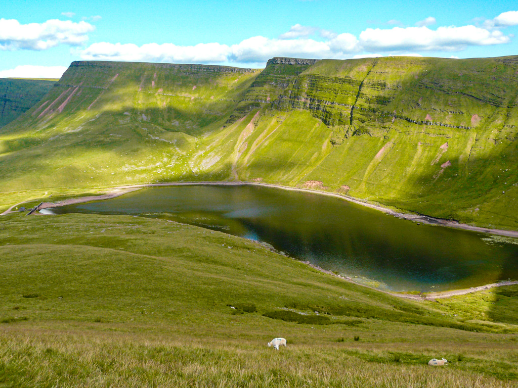
The Black Mountain stretches down to Llyn y Fan Fach. It is wild, rugged open moorland and forms the Carmarthen Vans on the western reaches of the Brecon Beacons.
Carreg Cennen Castle
The first castle was built in the 1100s on the initiative of the Lord Rhys but was later taken by the Normans and rebuilt.
I remember walking up with a group of friends and chatting so much that we took a wrong turn on the way back and walked down to Llandybie instead of Glanamman.
Luckily in those days there was a good bus service but it still involved changing buses in Ammanford so were very late getting home.
There was a tradition in the Amman Valley of walking up to the castle on Whit Monday – in Wales heritage and tradition are part of our culture and long may it remain so.
You can discover other ‘Letters from’ on Nation.Cymru by following the links on this map
Support our Nation today
For the price of a cup of coffee a month you can help us create an independent, not-for-profit, national news service for the people of Wales, by the people of Wales.
Get more trusted Welsh news
Choose Nation.Cymru as a preferred source in Google News to see more of our journalism.


Looks beautiful, great article.