


Letter from Din Lligwy
Warren Kovach
As you walk across the field, past the roofless medieval church and towards the wooded knoll, you can almost sense the ancients walking alongside.
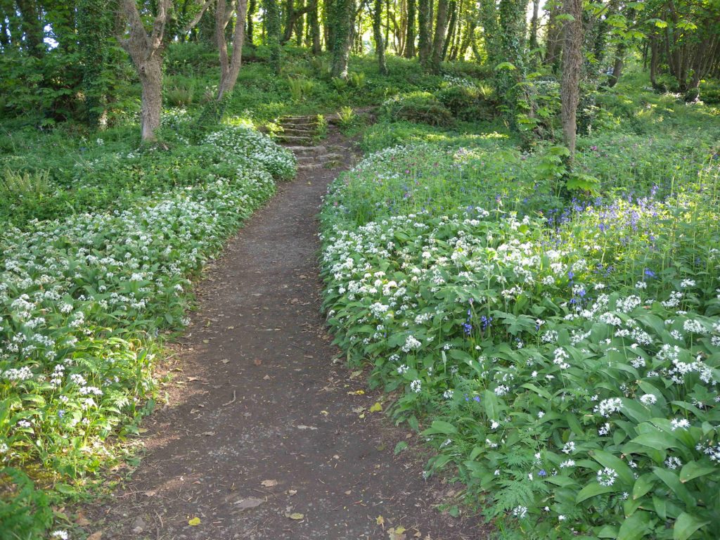
Pass through the gate and up the steps through the wild garlic-scented woods and you will see the walls through the trees. You are approaching the chieftain’s village.
Ynys Môn, an island steeped in history, is littered with prehistoric remains and artefacts.
Neolithic standing stones crop up in fields around the island, sometimes in groups of two or three, like farmers conversing on a misty morning.
Burial sites – mounds, cromlechs and passage tombs – show their care for the memory of their dead.
The variety of household goods, lost and buried but then later found, is astonishing – pots, axes, arrow heads, plus decorative items like brooches, beads and bracelets.
But what excites the imagination most, leading to pondering of what life must have been like in the old days, is the 1,700-year-old Romano-British village of Din Lligwy, overlooking the Irish Sea near Moelfre.
There are numerous places around Anglesey where the foundations of Iron Age round huts can be found.
In the 19th century, when early archaeologists began exploring them, they were referred to as Cyttiau’r Gwyddelod, “Irishmen’s Huts”, with the mistaken belief that they were the sites of early settlements of migrants from across the Irish Sea.
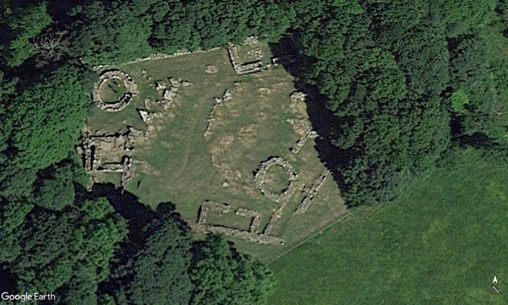
Din Lligwy is the most evocative of these sites. Well maintained by the Welsh historic environment service Cadw, it is a compact and well-defined village, enclosed by a massive stone wall.
It covers just 0.21 hectares, a five-sided area 53 m long and 48 m wide. Within the walls lie the stone foundations of two circular huts and four other rectangular buildings.
Excavations
Din Lligwy is first mentioned in William Camden’s history book Britannia in 1695, but it wasn’t until the archaeological excavations by W. Wynn Williams in 1867 that the true nature of the site was revealed.
He notes that many thought the circular remains to be Druidical temples, but his meticulous descriptions and finding of some pottery fragments led him to recognise them as dwellings.
The site lies on the land once owned by Lord Boston, whose Anglesey manor house, Plas Lligwy, stands just a field away from the village.
The 6th Baron, George Irby, was a keen archaeologist. After allowing Williams to excavate the site in 1867 he decided to do a more thorough job himself. His brother-in-law Neil Baynes was a solicitor who was also an archaeology enthusiast. So, they teamed up and began new excavations in 1905, which were published four years later.
They went on to found the Anglesey Antiquarian Society and Field Club in 1911. The society is still very active, presenting a programme of lectures about the history and nature of the island and several excursions each year exploring the wonders of Ynys Môn.
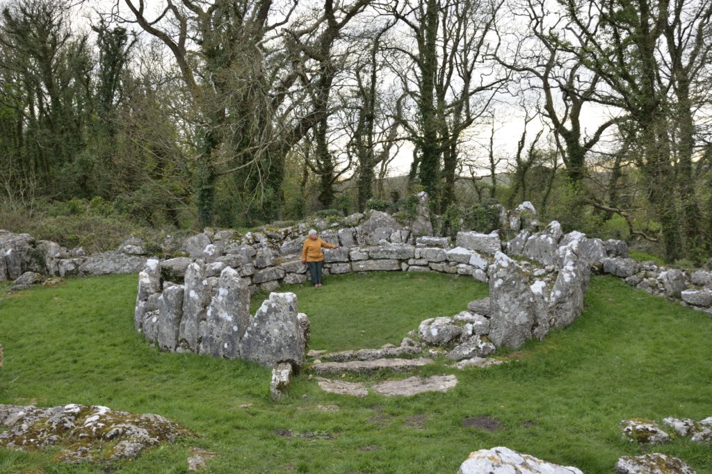
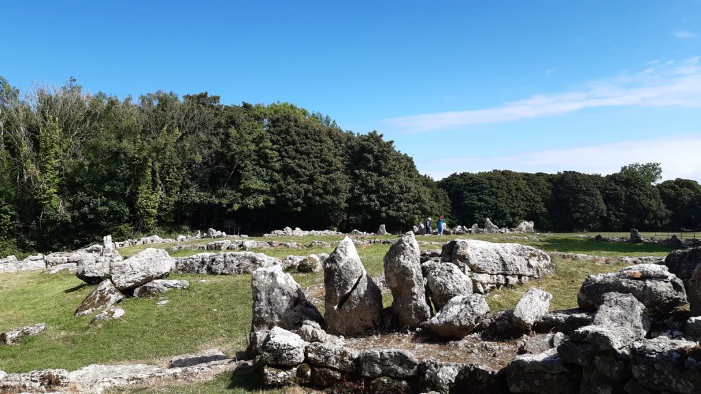
When you reach Din Lligwy the first sight is of the enclosing walls, today standing waist high at most. It is a massive double-layered wall, with two rows of standing slabs of limestone infilled with rubble.
Entrance to the village is gained through an opening in the wall, which leads directly into the first rectangular building. This was probably an agricultural building, used for either threshing grain or housing livestock.
Once inside the enclosure a tumble of huge rocks can be seen. Some are the natural outcrops of limestone occurring in the middle this plateau, but most are the foundations of the buildings, uncovered and restored by Irby and Baynes.
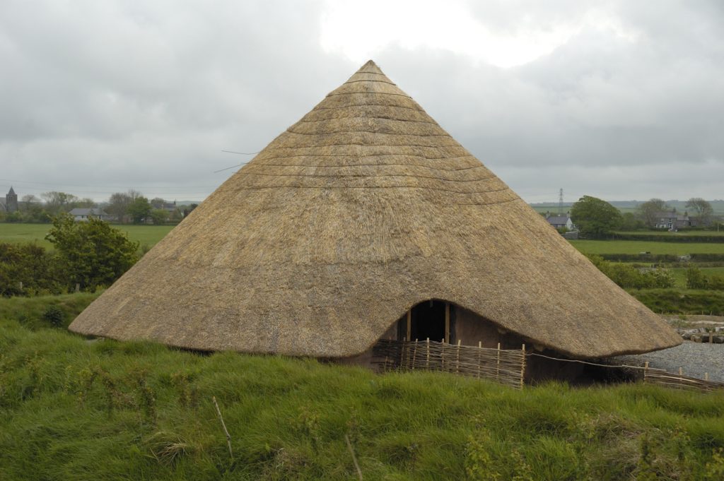
The most important and conspicuous building is a large round hut in the corner of the far side of the enclosure. This is likely to be the home of the village chieftain and his family. The foundation, an infilled double wall like that surrounding the enclosure, would have been topped by a large conical thatched roof.
The doorway, flanked by huge upright stones, faces out towards the centre of the compound. Opposite the doorway a section of the wall has a seating area built into it, possibly the place of honour for the owner, where he could look out across his village and welcome guests.
Found items
Excavations within this hut has revealed many household items. There were numerous fragments of local Romano-British pottery, but also some with decorative patterns and colours typical of those produced in the New Forest of England and further afield in Gaul (modern day France).
Also found was the handle of a glass jug of Roman manufacture and a silver ingot. Elsewhere on the site coins have been found dating from the reigns of Roman emperors Constantine I, Constantine II and Constantius II (A.D. 320-335).
Spindle whorls (weights used for spinning yarn) hint at the making of cloth, while part of a knife blade and numerous teeth and bones of domestic animals and shells of cockles, mussels and oysters reflect meal preparation.
The largest rectangular building has evidence of smelting hearths and metal slag; this was a workshop for making metal tools for the household and farm, and possibly for sale or trade.
All these items indicate that the site was owned by a wealthy family, able to import household goods, and with good connections with the occupying Romans.
It was definitely occupied in the 4th century AD, and probably sometime before that, but there is little evidence that it existed before the Roman invasion. During Roman occupation it was relatively peaceful in Wales, so settlements didn’t need to have defences that they might have required at other times.
The walls around Din Lligwy would have been built to show off the prosperity of the leader, much like a Premier League footballer’s gated mansion in Cheshire.
Decline
However, that prosperity seems to have declined after the Romans left. There is no sign of full occupation after the 4th century.
But, the finding of a 17th century clay pipe and an iron horseshoe of similar age indicate that people were still passing through, perhaps pausing to take in the view and wonder about who had built these ancient walls.
The additional find of a French coin dated 1657, adorned with the bust of the Sun King Louis XIV, gives a tantalizing hint of possible early tourism at the site.
As I descend from the knoll to head back to the car, the view over the Irish Sea is expansive.
It is a particularly clear day, allowing rare views of the Isle of Man across the water. The sweep of the beach at Traeth Lligwy beckons, as does the café there.
It’s time for a panad.
Support our Nation today
For the price of a cup of coffee a month you can help us create an independent, not-for-profit, national news service for the people of Wales, by the people of Wales.


