

Letter from Bryher, Isles of Scilly
Sarah Morgan Jones
Waking in the aftermath of the storm, the world looks greener and brighter. Those with event shelters who thought taking it down was advice not an instruction have paid the price.
The wind dragons of Scilly have rampaged through the campsite and laid waste to the vulnerable.
Those who doubled down with pegs, who turned their shelters into skeletons and pinned their kit down under tarps, or who – like us – lifted our tents wholesale into the heft of the hedgerows… we survived.
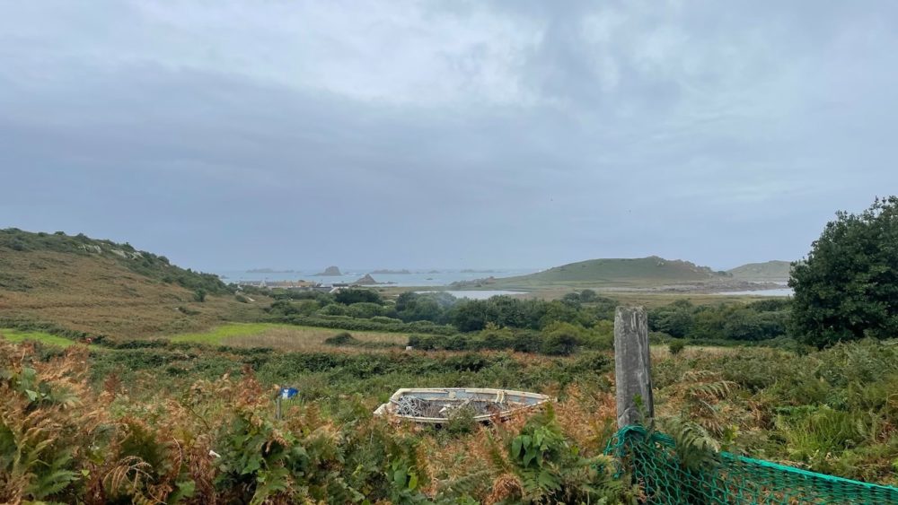
To be fair, the weather ’til then had been kind for our week on the tiny island of Bryher, just five kilometres in circumference and a permanent home to no more than 90 people.
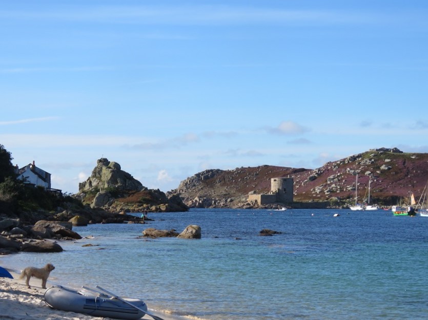
Situated just a hop, skip and, at the lowest tide, a wade across the sound from its luxury neighbour Tresco, Bryher has an identity of its own, which reflects the wildness of its western coast.
A map resembles something from the imagination of an adventurous child, with names like Badplace Hill, Droppy Nose Point, Stinking Porth, Great Bottom Carn, the Hole of the Horse and Hell Bay.
A better pair of legs on me would have taken me to all of the above, but amid the storm, my friend and her teenage and young adult children, well-seasoned Bryher visitors, traipsed along the bracken path to Stinking Porth to marvel at the south-westerly Atlantic power on the rocks.
At the end of a gloriously sunny day they would summon the energy to climb up to the neolithic burial ground on Shipman Head Down to the north of the campsite and take in the sunset over Hell Bay.
It takes commitment to get to the Isles of Scilly, 26 miles southwest of Land’s End.
From my home it took nearly six hours to reach Penzance, my friend and host, even longer from Nottingham.
Then, nearly three hours on the 0630 ferry, the Scillonian III, (or 20 minutes on the Skybus from Land’s End, longer from Exeter or Newquay, if you are so inclined) docks at the quay on the main island of St Mary’s.
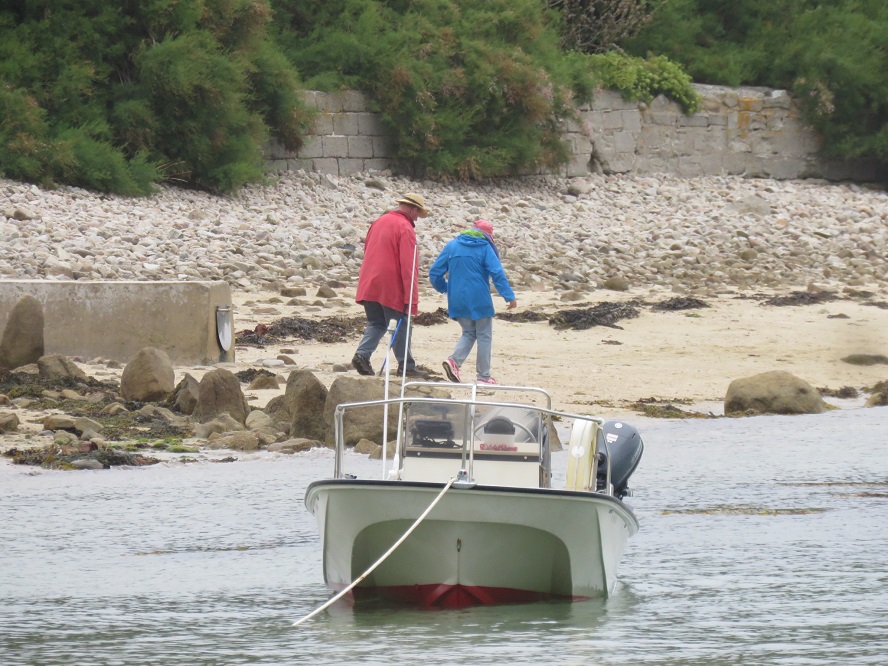
From there, smaller boats collect us and all the camping luggage and navigate the depths and the shallows to the northwest, with the uninhabited island of Samson rising first on our port side, its white sand beach and twin mounds looking tropical but bare.
Ahead, the southernmost beaches of Bryher and the first view of Cromwell’s castle on Tresco, the quays and the curves of the coasts, each providing access during the differing tides.
Happily, we land at the one built under the spotlight of Anneka Rice many moons ago, known as Anneka’s Quay, or more commonly the Bar.
Closest to the campsite, it is a welcome sight and far friendlier than the gangplank-onto-timber of old which was necessary at low tide before it was renovated and extended.
After human-chaining our luggage from our boat, Firethorn, to the awaiting tractor which provides the final haulage, we stroll the last ten minutes of the journey along unmade roads and beaten tracks to the campsite and set up our homes for the next week.
The journey thus far feels epic, and the last bit of the build is an effort, but once the canvas stands firm, the bed is ready and a G&T is in hand… well the view and the sound of the waves just over there…
This is my fourth visit to Bryher. I came twice with my friend and her mother and cousins when we were teenagers, just a little older than her daughters are now.
Back then the two of us stayed in a two-man ridge tent, one of several satellites to the family canvas mothership in which we all sought shelter from the passing storms in the evenings, eating beanfeasts and playing Trivial Pursuit.
Then, when my own daughter was three and I was pregnant with my son, I joined her again, along with my late brother and my children’s father. Her son was still little then, and he and my daughter have grown into fine adults and friends.
These visits, though, I barely remember, mere shadows of my former lives, so this is the first time I have come alone as an adult undistracted by any dependents, no responsibilities other than hauling my aching bones around the island and my first proper holiday in several years.
After a restful, rainy first day, on which we joined the Bryher fete, caught a glimpse of Michael Morpurgo scampering back home across the beach at Green Bay before the heavens opened, and made a major dent (emptied) the box of wine I had brought with me while the girls sang songs from Encanto into the wind… we woke to the start of four solid days of the finest weather we could have hoped for.
Getting into the sea was a priority and over the next few days I was spoilt for choice with walking distance options to do so.
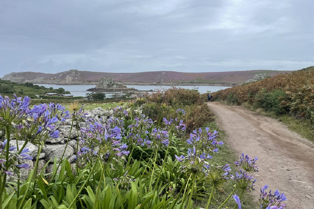
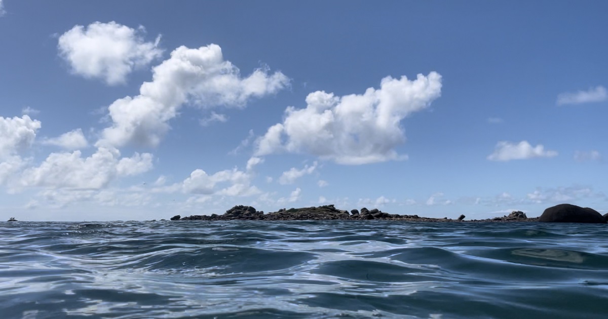
Rushy Bay, named after the Marram grass on the surrounding dunes on the south of the island, is a clear water paradise with grainy sands and dramatic rocky outcrops known as the Norrard Rocks and the mermaid’s playground, facing the deserted Island of Samson.
About half an hour’s walk from the campsite, down lanes lined with agapanthus, pittisporum hedges and strange succulents, the bay provides a final resting place to some of my friend’s mum’s ashes, one of the well-travelled woman’s favourite places on earth.
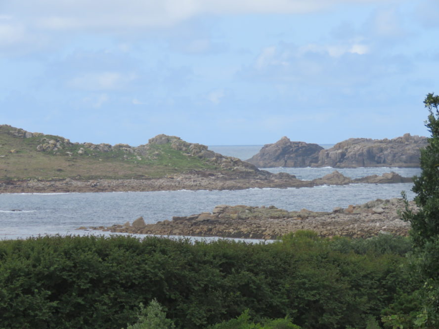
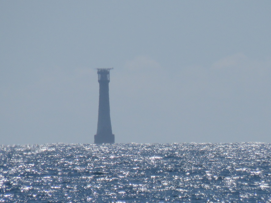
So cold and blue, the water took my breath away as I plunged in, the steep shelf soon shifting the sand beneath my feet out of reach. Far away across the sparkling sea, Bishop’s Rock lighthouse perched on the horizon mirage-like and mysterious.
To my right, the craggy rock named Castle Bryher was just one looming reminder why the archipelago is home to so many such beacons around a coastline which is littered with wrecks.
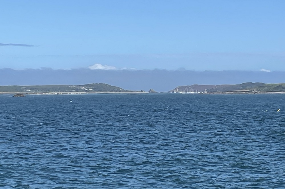
The next day, it is an evening tide which calls me into the waters between Bryher and Tresco, shallow and again gaspingly cold, with boats resting all around in the safest anchorage of the islands.
The view north between Hangman’s Rock and Cromwell’s castle shows the way out to the treacherous confluence of the Celtic Sea and the Atlantic, while looking south reveals the topaz watery highway to St Mary’s in the distance.
Cromwell’s Castle was built in 1651, in the wake of Scilly’s participation in a rebellion against Parliament and the islands becoming a safe haven for royalist privateers who attacked ships approaching from the west.
According to a Scillonian guidebook, the attacks angered the Dutch so much that an admiral from the Dutch Navy arrived to demand compensation from Scilly for the losses incurred. Finding no satisfaction, he declared war on the islands and proceeded to blockade them.
Fearing the islands would fall into foreign hands, Parliament sent its own force to thwart the rebels and placate the Dutch. Amid strategic supply problems the castle was built to offer better defence and keep a hold on those pesky royalists.
The declaration of war, however, was never officially rescinded so in 1986, after 335 years, the Dutch ambassador was invited to the islands to bring one of the longest and most uneventful wars in history to an end.
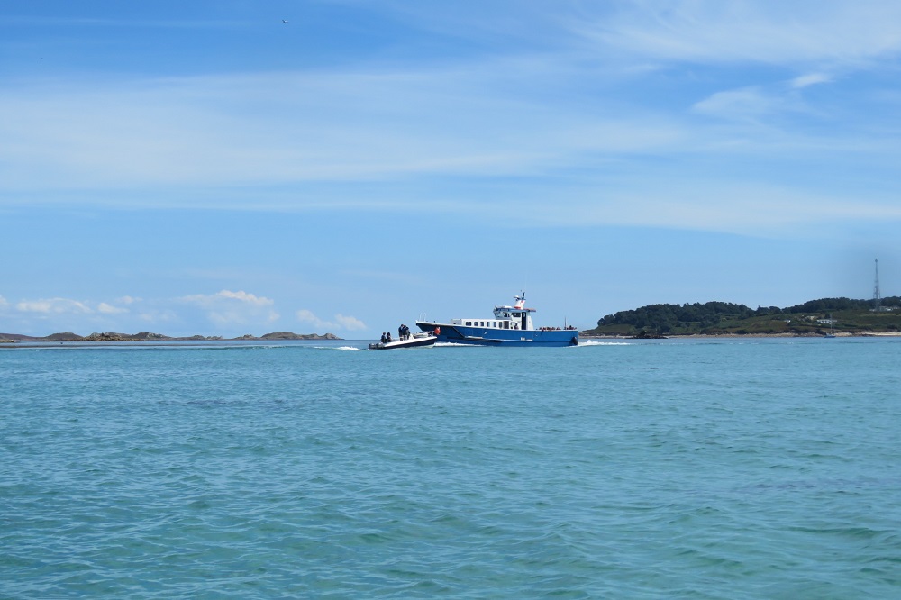
Midweek my friend hires a small boat with a four-stroke engine and enough room for five. After a brief lesson from the hirers we set off to Samson first, and beach up for a swim.
Although we are far from alone in the shallow waters, the island was deserted in the mid-1800s when food and fresh water ran out and the islanders who didn’t starve to death, finally left for good.
To us though, on that day, it was pure heaven, and I definitely peaked early on the Perfect Moment front.
As we only have the boat for a few hours, we didn’t loiter to look at the stony remains, but set off again, this time to Tresco for a toilet stop and a whizz round the small supermarket which boasts premium prices for premium goods.
We then make our way around the southern tip of Tresco, eyeing its long golden beaches and its ancient Abbey and head out towards the Eastern Isles, St Martins and Teän passing a long-distance paddle boarder, a waving water skier and some moody looking cormorants on the rocks.
We see the Scillonian III setting sail for Penzance from St Mary’s and tall ships and yachts to the north in waters forbidden to us.
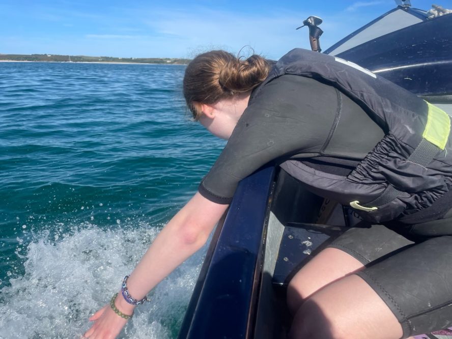
The teenagers trail their complexities into the water either side of the bow, their thoughts swimming deep amid the seaweed, their eyes smiling from turquoise to cobalt as they reflect the world unseen.
At the helm, their man-sized brother motors us all deftly windward, grinning with the daring delight of his inner boy, while taking the responsibility of steering us safely across the open waters between islands very seriously.
Returning to Bryher, the tide is high and our tummies are rumbling. I have reached peak happiness and had an afternoon of perfect moments.
On the eastern slopes of the island, the old field structures remain in use, narrow strips of land, hedged in by pittisporum, grown tight and tall to protect the crops from the brutal winds.
I had hoped to join a farm tour to see how the world worked on that landscape, and hopefully find out more of the Bronze-age warrior woman who was found in the field… but the farmer arrived to say it was off as he had a septic tank emergency to deal with, so I pottered off none the wiser.
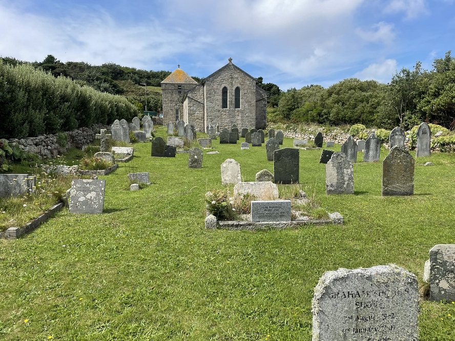
Finding myself alone with no plans, I wandered down to the old All Saints church and explored the graveyard. Groups of family-named headstones teetered at odd angles, covered in moss.
Jenkins, Ellis, Thomas, Hopkins, Stedeford, Trevilleck, Pender: Welsh names among the Cornish, perhaps seafaring folk who made the journey to a land that seems so familiar in many ways to the coast of west Wales, and decided to weigh anchor in fairer weather and seas.
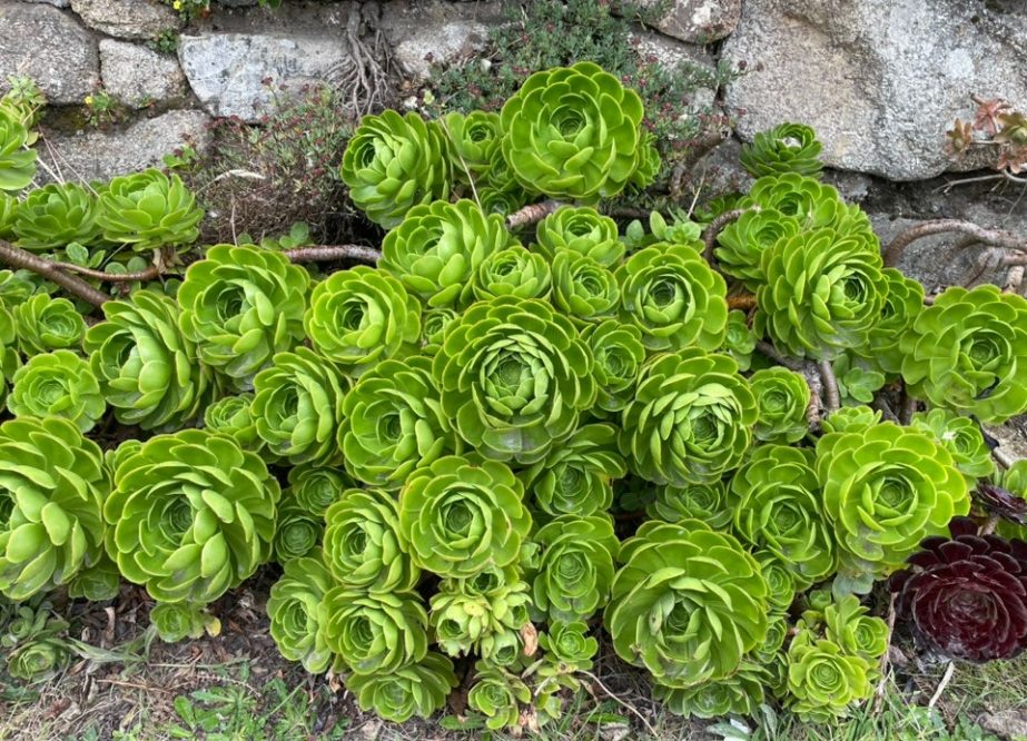
Early potatoes, daffodils and year-round greens come from these parts, but as making a living off these lands is hard, the leaning to ornamental flowers such as aeonium is a good source of income.
Indeed, as well as growing rows of them in the fields, the drystone walls see both the aeonium aboreum and the dramatic Schwarzkopf variety growing dramatically and freely alongside the exuberant agapanthus.
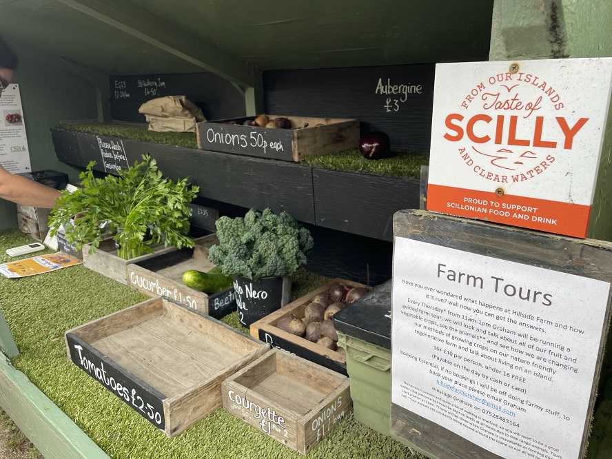
At the end of each garden and in remarkable little barrow huts, the stroller can find local veg, cakes and crafts for sale with honesty boxes, replete with contactless options and instructions on where to point your phone for the best signal.
The girls in our party would race off to the bake box down by the old church and come back with exotic offerings like honeycomb meringues, salted caramel donuts and cinnamon buns which had been set out in individual paper bags at the whim of the unseen confectioner in the farm across the way.
It is a summertime and tourist economy on the island, with the young people working hard through the summer in the one bar or shop or hotel or campsite, fishing for tourists from the boats and taking part in gruelling and dramatic gig races to relax.
Sun-bleached, wind-tanned and strong, these are children of the island who can probably only ever hope to inherit rather than buy, as like so many beautiful places, they are priced right out of the market by holiday homes and tourism. No doubt many flee to the mainland and live a world away from taking a boat to school every morning.
As I watched the islands disappear from view after a week which was at once very long and far too short, I wished I could stay forever.
Support our Nation today
For the price of a cup of coffee a month you can help us create an independent, not-for-profit, national news service for the people of Wales, by the people of Wales.
Get more trusted Welsh news
Choose Nation.Cymru as a preferred source in Google News to see more of our journalism.


One of the last places in Britain that Cornish was spoken as a community language. Sad really what happened.
Cornish is a sister language to Welsh
I believe the Cornish language actually disappeared on Scilly some time before the nearest areas on the mainland, some of the odd place names occur where the name has been translated to something that sounds like it in English, rather than by the meaning of it.
Nice photographs and you really gave me an appetite for Bryher and the rest of the islands…
You mentioned having seen ‘tall ships’, was that a reference to the entrants to the race of the same name which I suspect may have coincided with your visit?
I’m not sure if they were ‘those’ tall ships (just checked and no, I don’t think so), but they were glimpses of masted beauties in the distance, beyond the realm of our safe/permitted zone. So much more to see and do than we could manage, more to be said about the history, the language…just day dreaming about next year…maybe a different island. But that’s along way off in both time and space.