


Letter from Mynydd Enlli
Judith Kaufmann
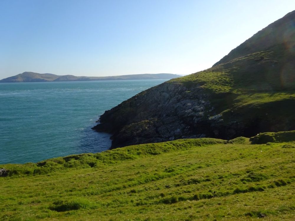
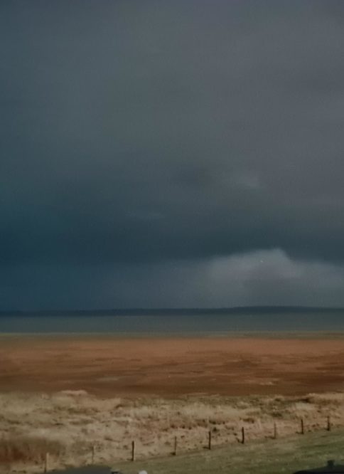
I am surprised to see it so close. Having spent the whole first day on the flat southern part of the island, with a soupçon of Wicklow and Penfro in the fading distance, I came onto Mynydd Enlli this morning to see the other side.
There’s the end of Llŷn mainland, and its range of peaks from Uwchmynydd to yr Eifl over the clouds seem insurmountable and vast. It looks as if a veil of a snowstorm was gently blowing over, or mist layering them with tissue paper.
In front of me some distance below, black-backed gulls sail over the divide of the water. On the right, it is rippled and calm-blue, further left it meets tectonic plates of silver-smooth but more dangerous-looking sea in a line of stitches.
The constant of oystercatcher trilling reminds me of home. Not my current home between the purple valley of Dyffryn Ogwen and the round-headed Carneddau, but the one where I grew up.
Lower Saxony
Similar sound-waves flick through the skies over the Lower Saxony Wattenmeer, the Wadden Sea. Saltmarshes are sometimes flooded and regularly flocked with redshanks and greenshanks, knot and dunlins, sandpipers, whimbrels and terns, all finding food in plants and animals that have adapted to the salt.
Like here on Pen Diben, scurvy grass collects the salt in special leaves which it then drops, thrift stores water in dense leaf cushions to slow down evaporation and concentration of salinity. Oystercatchers and curlews add their piping and gurgling homely background music.
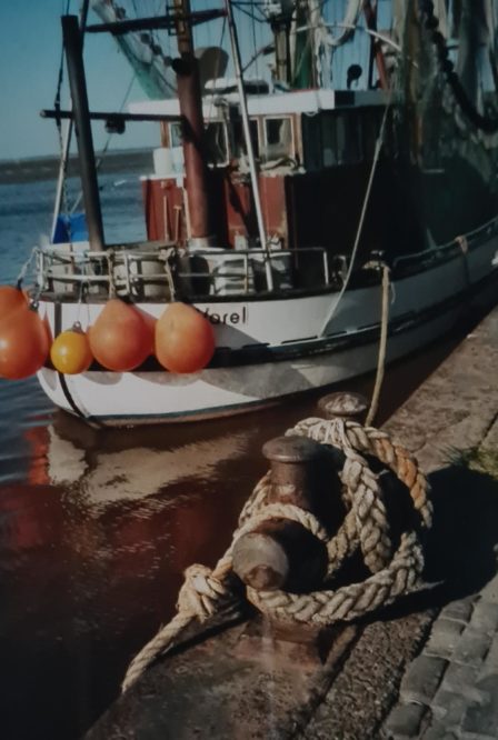
My sister Mirjam and I often rode our bikes to the harbour after school to go swimming. The tidal calendar on the kitchen pinboard, available free at shops in town, told us whether it was good to go in the remaining hours of the afternoon.
Enlli islanders and visitors, gratefully and sometimes annoyingly dependent on Colin the boatman’s feeling for tides and currents, know how ocean movement is an essential ingredient of life and cynefin on island and coast.
We’d cycle along the Hafenstraβe, built straight from the windmill hill where we lived, along the inner part of the harbour basin, accompanied by the Bahlsen factory’s biscuity sweet-smell.
Saltmarsh
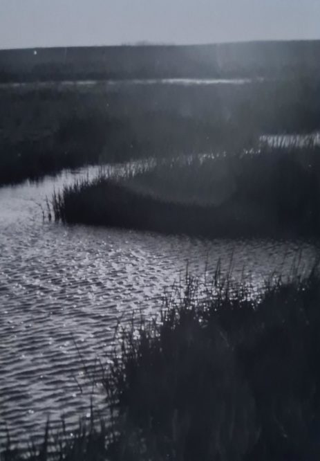
A big sluice gate set into a grass and sheep-covered dyke cuts off the harbour basin from the channel running through the saltmarsh outside the dyke where we’d swim.
When the high-lying blanket bog of the area was undermined by stronger tides from the north, the land sank and flooded and was dyked in stages going back to the 1500s, and dyke building became another essential part of cultural life.
On the seaward side (“buten” in Lower German, or outside) of the dyke, beyond the little basin where the shrimp ships awaited high tide, and where we parked our bikes against a bollard, the shipping channel continued straight and narrow, but it had no reinforcements, and when the tide was in you could glide into the water from the saltmarsh meadows, barely needing to wade in.
Mudflats
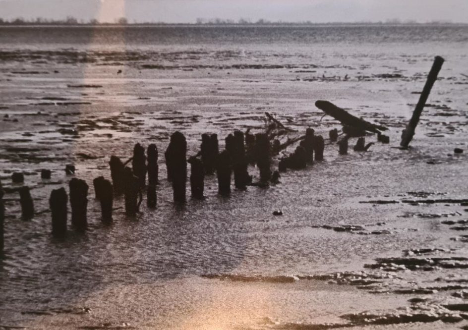
Low tide however exposed the mudflats, dark-chocolate brown (at least 75% cocoa solids), sticky and fizzing with micro-life. This mud, or watt, is pure biomass, and when you walk on it or scratch the surface, you find living black gold.
Local spas have long used this watt-black bio-energy in face masks and baths, and you can even go on a watt walk to the red and white stripes of the Arngast lighthouse – this one is traditionally round and squat, not the unusual square of Enlli. Nature walk on the bottom of the sea, or pilgrimage of rejuvenation and healthy living.
We used to swim at high tide, or an hour either side. Before the term “wild swimming” was invented, we just swam. Five hundred metres, and then the channel opened out into the Jadebusen bay, an inlet with a narrow collar between the major port of Wilhelmshaven and the Butjadingen peninsula. When the weather was sunny, the watt shared its stored heat with the water, and it was warm.
This was hardly the local lido, but the harbour saltmarsh had a loyal following. One of the regular swimmers was a lady whose name we never asked and who brought a car inner tyre in which she’d spend hours on the same spot in the water, much to our amusement.
My parents moved away many years ago and I’ve lost touch with this wide-skied place of poplar rows and lapwing fields. Last time I visited, I found that the ramshackle wooden and corrugated-iron boat sheds and shacks, sunken into bushes by the waterside, had been turned into cafes, and fish mongers become upmarket restaurants.
Here on my island mountain, facing north towards Mynydd y Gwyddel, I hear the reflections of the Wattenmeer in the calling waders and the smells of silence in the morning when there are no waves. There’s a quality of light that the Carneddau mountains at home out-bulk, and I can feel something tug inside with the distant tinkle of rigging.
Later, I walk across the morfa heli towards the southern end of Enlli. There’s white on the fields in the sun this afternoon: daisies, flecks of wool, west-blown sand. Across the narrow lle cul, past rocks named Carreg Dwy Awr Drai (Two-hour tide rock) or Trwyn Siani Penrhyn (Siani Penrhyn’s Nose) where the heavy, marwnad-singing seals are draped over the drying crags like wet pillows in shades of pebble.
Gorse
Thrift-cushion lawn, like peaty moorland, springs my steps. It is embroidered with its first flowers and those of spring squill and llygad Ebrill, their colours reflected in the gorse, the Irish-blue Sea and my windburnt cheeks.
Buckshorn plantain has arranged its leaves in perfect furry rosettes. Thinking of the storm and the shipwrecks at the tip of Maen Du, I turn on my heels and walk back along the western edge.
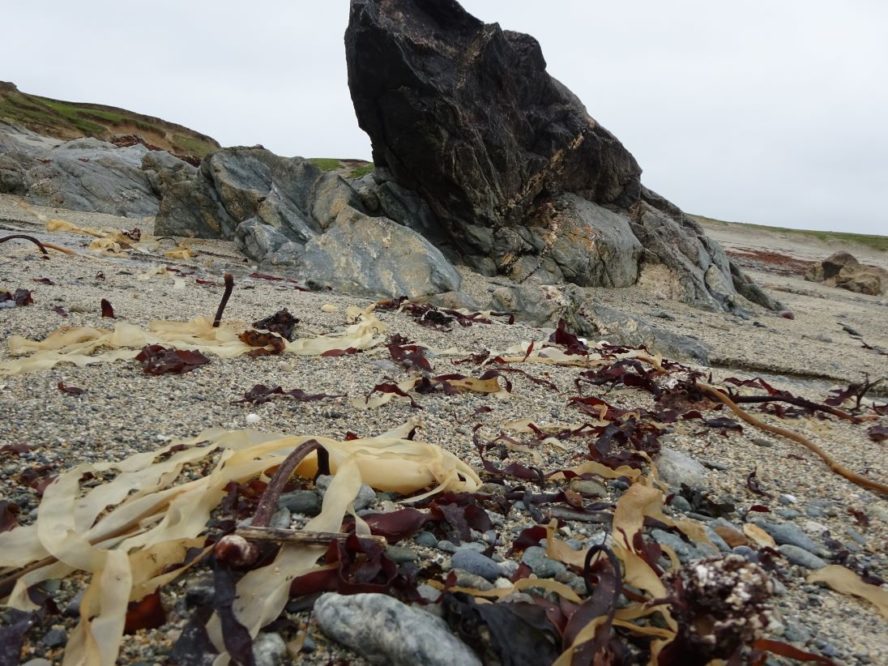
Salty seaweed-rot finds the nose before my eyes can locate the red entanglement on the coarse sand of Porth Solfach.
The approach to the beach is a story of continuous cover-ups: Sand blown over plants growing on the path. Bird steps stamp-marking their three fingers on the sand.
Bits of seaweed and coloured plastic string half hiding the footprints. Soon the next tide will wash over the seaweed again. A sandhopper makes acquaintance with my boot.
Fist and melon sized pebbles lie still, broken shells in their embrace. A breeze whispers from the west, while birds are calling from all directions.
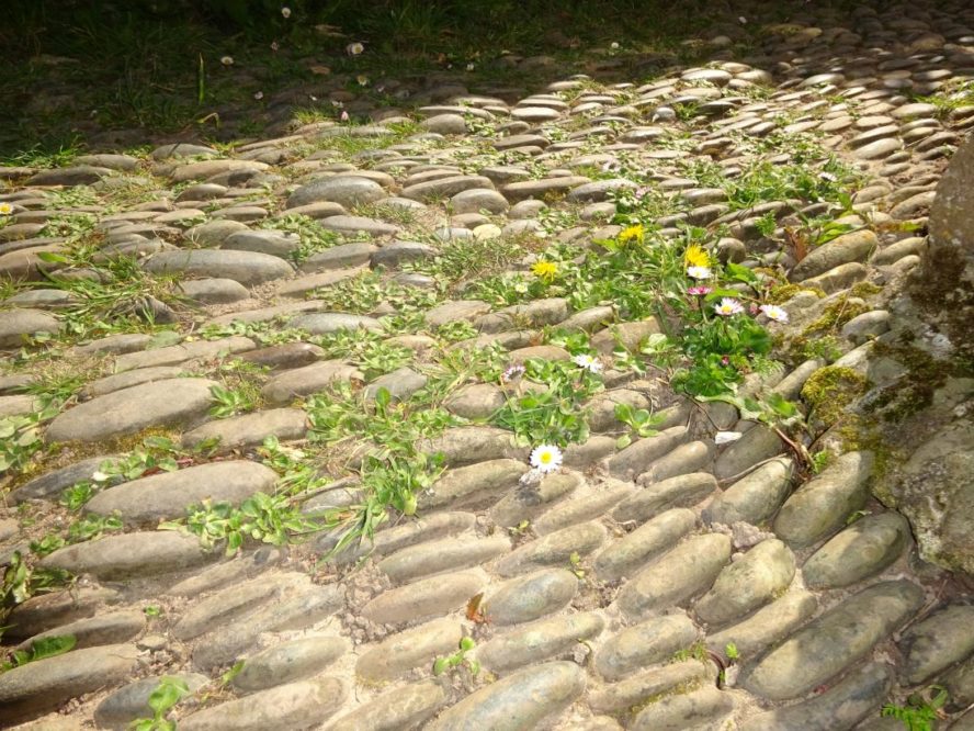
These pebbles, shaped and smoothed by centuries of tides, rivers and earth movement, are old. Islanders have pushed them into the cloddiau between fields to decorate and strengthen them, have built walls and laid them edgewise in their yards where they have been witness to generations of inhabitants and visitors, eavesdropping on their ambitions, their dreams, their failures.
When sea levels eventually rise and low-lying lands are swept away, together with the dykes that are meant to protect them, these pebbles will once more be at the bottom of the sea.
Support our Nation today
For the price of a cup of coffee a month you can help us create an independent, not-for-profit, national news service for the people of Wales, by the people of Wales.


