Perthyn: Belonging and hiraeth in Pontypridd
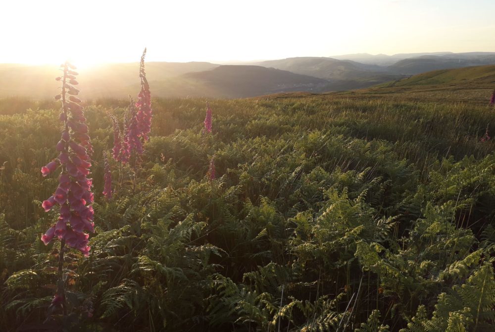
Ken Moon, Chair of Tir Pontypridd
Many of us have enjoyed accessing different spaces around our town over the years.
Spaces that provide us with a strong sense of Perthyn, of feeling related to and belonging with these places. People make spaces, places, and in the act of doing so name them. In their turn these places may also leave us with a strong sense of Hiraeth, a longing for spaces that hold a special place in our hearts, long after we have left them, or they us.
We carry our memories and our names for them in our hearts, wherever we may go
For those who have grown up ym Mhontypridd, memories of accessing land around our communities go back several generations. Childhood memories of exploring, Winberry picking, den building, fire lighting, camping, and swimming surrounded by nature creating a strong sense of connection, of Perthyn, to these special places.
For those of us who have moved here in later life these memories have been formed more recently. Visiting places where we go to get away from our everyday cares, to walk, run, cycle, exercise dogs, or inexplicably leave pants in the bushes for litter pickers to find. Places we can go to be with nature in our own myriad ways.
Places that we return to time and again, feeling welcomed, nurtured, loved.
Sacred
Such places may become sacred to us, deep bonds formed through the ritual of repetition, quite places where we can commune with something greater than ourselves. Places becoming imbued with deeper meaning. Places where we may have scattered the ashes of our loved ones; places of remembering providing a connection to our ancestors,
This landscape of our ancestors can be very dear to us.
We can become so used to being able to freely access spaces, of thinking of them as public places where we belong, that it rarely occurs to us that these spaces places belong to others. It can therefore come as an unpleasant surprise when we find ourselves made to feel unwelcome or excluded from such places.
What becomes of our sense of Perthyn, when all we have left is our Hiraeth?
Those who grew up ym Mhontypridd can fondly remember the unwritten laws and customary rights of access between those who own these places, and those who access them for a variety of purposes. Customs of access etched deep into the relationship between those who have been farming here for generations, and those who settled later.

“I really had no idea how lucky I was growing up in the area when the farmers and landowners had a deep connection to the land and recognised it was OK to share. There was an unwritten understanding, ‘you don’t interfere with my farming, and you can wander where you like’”. Robert Peterson, Save Craig Yr Hesg
It is often not until such places are advertised as being for sale, change hands, or become fenced off that our feelings of Berthyn a Hiraeth become more strongly felt. And when we see places where we once felt that ‘welcome in the hillside’ become adorned with, keep out, and no trespassing signs. We find ourselves ‘displaced’.
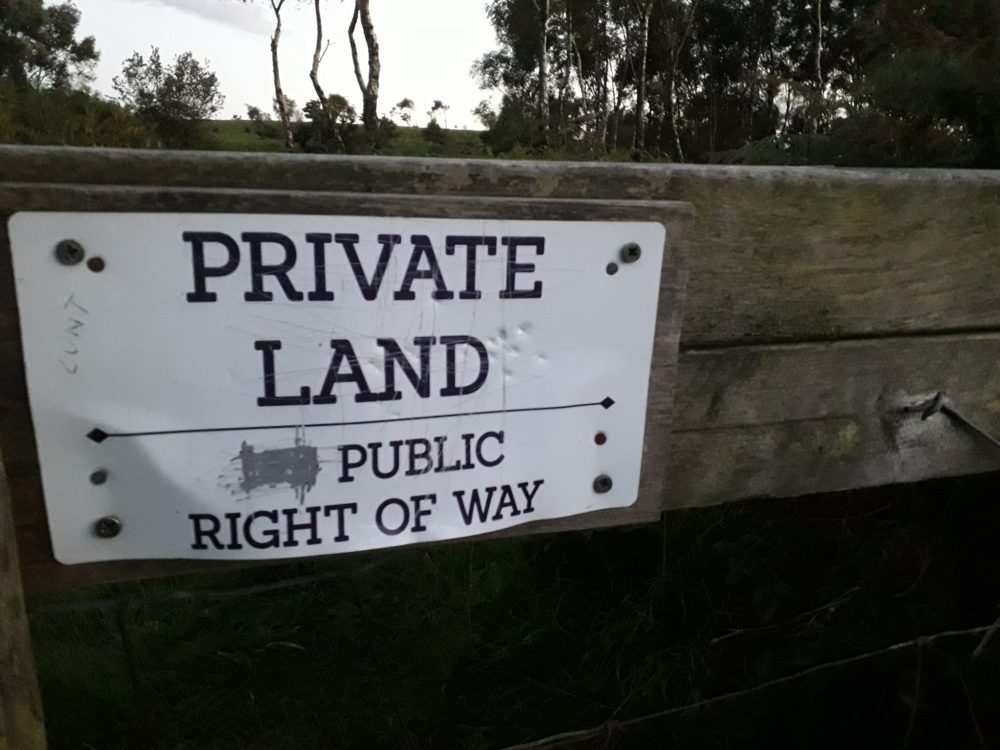
An ages old process of exclusion displacing people from land and nature once again.
Gwrando/Listen
Yn Gymraeg the names given to places are themselves imbued with meaning, often relating to the way in which such places have been accessed and used by y Cymry who belong to them. If we take the time to listen, we can learn a great deal about the story of a place from the names they have been called since people have known them.
Y Graig is a space that was once so well known as a place of rocks, and of quarrying them, that this is what the place is still known as today. In an earlier time, other people may have known this bryn by another name, but ‘the Graig’ is the name by which it is known by most people living ym Mhontypridd today.
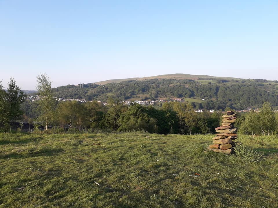
As I write I can look southeast towards Caerdydd from my desk window in Pwllgwaun, a damp pool of a place, past the shoulder of Maesycoed, a once wooded field place, towards Y Graig, the rocky place. And once in a while, Y Graig will call to me, cast its spell of Perthyn upon me, and cause me to leave my desk to fill a deep Hiraeth.
I leave my front door and walk through the lanes of my children’s own formative years, briefly join the flow of the Afon Rhondda as it runs past Y Clwb Rygbi. Crossing Sardis carpark, I traverse the culverted and buried Nant Gelliwion stream, and on its long-buried bank take the cut through to follow the route of the old Barry Railway.
This route carries me past the site of Graig railway station, demolished to be replaced by the now itself obsolete telephone exchange. I cross the raised walkway above the carpark of Ysbyty Dewi Sant and where the line of the old railway tunnels beneath Y Graig I join the steepness of High Street before turning into Graig Street, beyond which lies Y Graig.
At the end of Graig Street, a steep footpath climb brings me to the Pontypridd Circular where it passes into the open space of Y Graig. Like many mynydds of the Cymoedd Cymru Y Graig is a landscape of once open grassland slowly becoming scrub woodland, a ffridd of a place where residents are accustomed to roam at will in place of cattle.
Right to roam
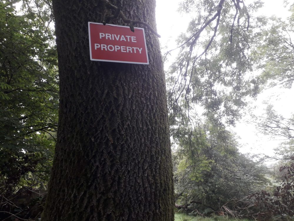
Here in recent years observant residents have reported that their accustomed right to roam has become diminished. Small plots of land changing hands have borne testimony to new signs erected warning the unwary to ‘keep out – private property’. As much as people feel that they belong to Y Graig, Y Graig itself also belongs to other people; a tapestry of ecology, reflecting an underlying tapestry of ownership.
From this elevated position above the town my eyes are free to fly across the valleys to the surrounding hills & mynydds. Looking South from Y Graig my vision is free to soar to the whaleback hill that became a mountain. Y Garth rises from the sea of surrounding urbanity that is Dinas Caerdydd, and the commuter villages of Ton Teg, Church Village & Llantwit Fadre, like a humpbacked whale breaching the open ocean.
Y Garth, the enclosure Yn Gymraeg, is ironically the nearest area of open access land for the people of Caerdydd to escape to. A place that was so full of meaning for the ancient peoples of this landscape that they built five bronze age burial mounds, three of which can still easily be seen, strung out along its ridge running from east to west.
Between Y Graig & Y Garth, clinging to the lower south easterly slopes of Y Griag, along the taf valley to the northern banks of y Nant-y-Fforest, the forest stream, grows the ancient woodland of Coed-Fforest-Uchaf, the highest wooded forest, which gave the nearby Trefforest, forest town, its name. But the name fforest has little to do with coed.
During the Covid 19 pandemic many of us used our hour of daily exercise to lose our sense of time exploring the landscape around us. And during the Covid 19 pandemic many people also found the time, inclination, and resources to fulfil a long-held dream to become owners of land, using their new rights of ownership to exclude others.
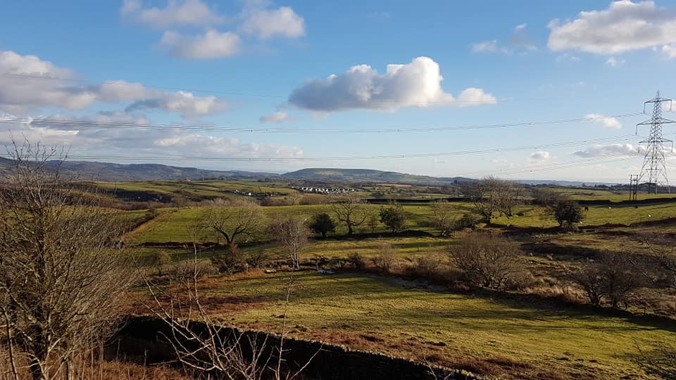
But long before the pandemic the people who lived in this area were finding that their ancient rights of access to land were being challenged by new landowners.
Colonisation
When William the Conqueror led his Barons on a royal ‘pilgrimage’ to St Davids in 1081 much of the land of lowland Glamorgan came under the sway of the Norman Marcher lords, who quickly set about acquiring the rich farmland, and the right to rule over the population of the ‘kingdom of Glamorgan’, under their own Marcher laws.
Over the following decade the lands south of Y Graig to Y Garth become a fiercely contested border. One of the principal tools by which the Marcher Lords excluded the indigenous Cymry from their own lands was through the imposition of ‘forest law’.
From the Latin ‘foris’, these laws operated outside of common law barring the common folk from practicing their traditional grazing or foraging rights from lands held in common.
Historically then, unlike woodlands, forests were places of exclusion.
Today nestled on the northern banks of Nant y Fforest, above the Treforest Campus of the University of South Wales (on which sits Ty Fforest or Forest House), lies Fferm Forest Uchaf. Following the Pontypridd Circular Walk from the open landscape of Y Graig towards Fforest Uchaf farm takes you part of the way along the route of an ancient trackway which once carried farm traffic between Y Graig & Y Fferm Forest Uchaf.
Where this trackway crosses the boundary to the farm today there is a style, from which a well-marked footpath takes you through pleasant rolling fields of mixed grazing, past a large and inviting pond, and along this ancient trackway through the yard of Fferm Forest Uchaf, and then beyond to join the course of the Nant-y-Fforest.
Unwelcome
Despite the idylic surroundings of Fferm Forest Uchaf residents have long reported being made to feel deeply unwelcome for simply going about their ancient right to walk along this old trackway. This itself is a form of exclusion. The more unwelcome people feel in walking these old paths then the less likely they are to walk them, and the less people walk them, then the easier it becomes for landowners to legally remove that right.
Access has been restricted in recent years to the land holdings immediately above Y Graig, with signage appearing on fences warning walkers that places where they had once roamed, are privately owned with ‘no public right of way’.
The open accessible nature of Y Graig, and Y Garth are vitally important places that are very valuable to people who live in the area. So much so that when a large tract of Y Graig appeared on the open market during lockdown. The community attempted to purchase and protect their access to it but were refused had their offer refused.
In the opposite direction northwest of Y Graig looking our across Y Cymoedd Gelliwion towards Maesycoed, lies the ruin of Llandraw Farm, Mynydd Y Glyn rising sublimely in the distance.
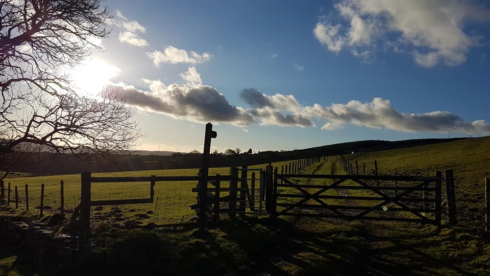
Yn Gymraeg the word Llan demotes an enclosed settlement of the early Celtic Church, usually followed by the name of its founding saint. In this case however ‘draw’ translates into ‘yonder’. Implying that this may have been the farm of the nearby religious communities of Llanwonno or Llantrisant.
Prior to the global pandemic Llandraw Farm was another place to which I often found myself drawn. Myself and others found the ruined farmhouse, and the fields surrounding it to be imbued with a deep sense of Berthyn a Hiraeth. A place of deep spiritual meaning to those who once had the privilege of spending time there.
Change of hands
During lockdown the legal ownership of Llandraw Farm changed hands, from the guardianship of an older farmer who understood the relationship that residents had with the land, to that of a younger family member who quickly moved to terminate the customary rights of access residents had long enjoyed.
Bereft of their spiritual connection to this place those affected spoke of how being excluded had a deep impact on their mental health, at a time when they really needed to connect to the land.
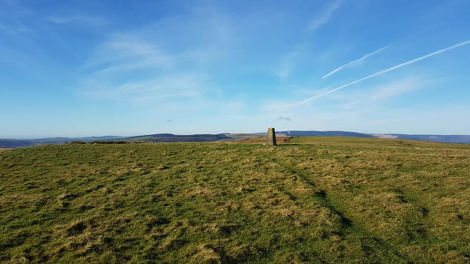
Above Llandrw Farm lies Mynydd Gelliwion, an area of open access forestry managed by Natural Resources Wales.
This monoculture woodland climbs towards a large area of open access hillside, and the summit of Mynydd Y Glyn. At 362 feet above sea level this is a wonderful area of open access land to walk or ride to, a great place to sit and enjoy uninterrupted views across the surrounding hills towards Mor Hafren, the Severn Sea.
Here local renewable energy firm Pennant Waters “a local company based at Hirwaun and operating nationally” and “Wales’ largest home-grown renewable energy company” has submitted plans for “up to seven wind turbines with a blade height of up to 155m” which could generate “up to 30MW of electricity”.
Whilst they generate much needed renewable energy the imposition of such schemes on our local landscapes are another means by which people are feeling excluded from their own landscape, their sense of Perthyn being gradually eroded.
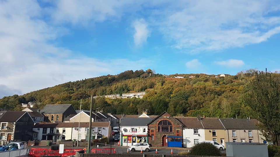
Returning our focus to Y Graig and from there looking directly north out over the Afon Rhondda we can see the community of Graigwen, white rock. The rock that may have given the community its name is now known locally as Eagle rock, for the way it overhangs the ‘hollow’ in which sits the community of Pantygraigwen.
People power
Here, behind the houses on Aelybryn, the eyebrow of the hill road, lies another parcel of land that changed hands during lock-down. Again residents wanted to protect this land, discussed a community purchase and pooled their resources to purchase the land for community use, but were outbid at auction.
Several years previously, having seen the woods above Graigwen pass through the hands of one developer after another the community here formed a group and raised the funds to purchase them.
Not being ready to purchase a local resident stepped in to secure the woodlands allowing the community the time they needed to organise themselves and raise the funds. The woods the people of Graigwen belong to, belong to them.
Within site of Graigwen Woods another recent land purchase means residents no longer feel free to roam where they once did. Beyond these fields runs the Pilgrimage Way to Penrhys known locally as the Darren Ddu, black edge, road. Crossing this ancient way brings us to the fields above Craig-Yr-Hesg, the rock of sedges.
Here the community of Glyn Coch, the red valley, has fought a long running campaign to save their place of belonging from an international quarrying concern. But the fences have gone up excluding generations of residents from their precious green haven; their exclusion reinforced by bailiffs legally empowered to act in compliance with the laws of property ownership.
Threat
Returning to centre ourselves one last time upon Y Graig we can look east across the Afon Taf, beyond Pontypridd ‘common’ (a common that is not a common) and raising our eyes upwards above Pontypridd golf club we can see the summit of Cefn Eglwysilan, the ridge of the church enclosure. From this, the highest mynydd in the area, a walk up the trig point rewards those who climb its summit uninterrupted views in all directions.
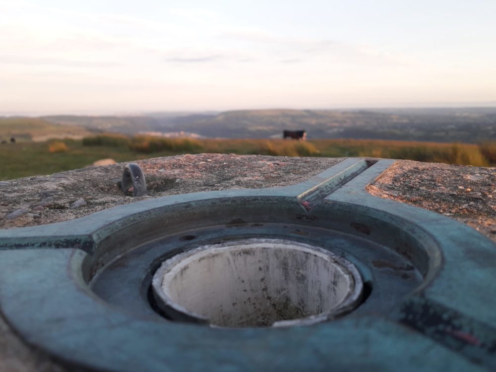
But here again, this sense of unspoilt isolation is threatened by another renewable energy firm Bute Energy who are pushing hard to develop the Twyn Hywel Energy Park. This will see the construction of 14, 200-meter wind turbines, on much of the open access land surrounding the village, and former stronghold of Ifor Bach, Synghenydd.
Below the Eglwysilan road another renewable energy firm, Renantis has recently started a public consultation for their “emerging plans for a new solar farm”, Glyntaff Solar around Byn Tail, dung hill, Farm. Between them these two schemes will radically transform the landscape on the northeastern bank of the Afon Taf at Pontypridd.
And here we come full circle, from Y Garth to the south, Mynydd Y Glyn to the northeast, Craig Yr Hesg to the north west, and Cefn Eglwysilan to the west. In each direction our eyes come to rest on areas of belonging from which the people of Pontypridd are finding that their ancient rights of access being taken from them once again.
This is one town, in one valley, bearing witness to a pattern repeated across Cymru.
Connection
Despite the power of ownership to exclude us, Perthyn a Hiraeth remain powerful forces that connect people to their landscape by their very interactions with the places that matter to them. Whilst ownership confers the power to exclude, Perthyn a Hiraeth bestow powers of inclusion upon us. These landscapes call out to us, invite us to appreciate them, welcome those of us who would care for and look after them.
As we hear the call, the voice of this landscape is heard by others too. And so, as communities of perthyn we must find ways to work together, to find a new balance between the needs and desires of those who own, or week to own land here, and those who would work to prevent the exploitation of our land, and our exclusion from it.
Our Hiraeth can be felt most keenly precisely because we have been excluded from the places that matter to us, the places where we feel our sense of Perthyn most strongly.
It is people who make the spaces in our landscape places, who connect with them, access them, use them, bestow names upon them. And it is people who have created these landscapes over hundreds of generations, who have lived within the land creating rich tapestries of biodiversity through farming and forestry.
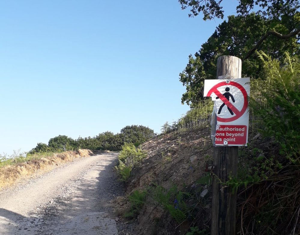
But most Cymry living yn Ngymru today are struggling to live sustainably in the landscapes of our ancestors.
Yr ateb/The answer
How can our communities be true to their Gwlad, and live sustainably within our landscapes, if we are unable to access, or have little control over our own Tir?
In the absence of community access to land, then one of the only way communities will get to decide how the land around where they live can be managed sustainably will be by becoming the owners of that lands that surround them.
It is the stories of Perthyn a Hiraeth, of the communities fighting against inappropriate developments’ on their doorsteps, of ownership and exclusion, of failed attempts to secure access and ownership, and of the inspirational community purchase of Graigwen Woods, which have inspired the setting up a new community organisation, Tir Pontypridd.
Tir Pontypridd is a town setting out to purchase land for community use.
Learning from those ancestors who once saved a small proportion of their weekly wages to build the community infrastructure so desperately needed for their wellbeing in the industrial valleys, Tir Pontypridd is inviting their local community to join in membership, paying a little each month to buy land today for future generations tomorrow.
Support our Nation today
For the price of a cup of coffee a month you can help us create an independent, not-for-profit, national news service for the people of Wales, by the people of Wales.


