


Bangor University researchers find ship which sent iceberg warning to the Titanic lying at the bottom of the sea
The ship which sent an iceberg warning to the RMS Titanic, before the ocean-liner sank, has been identified lying in the Irish Sea by researchers at Bangor University.
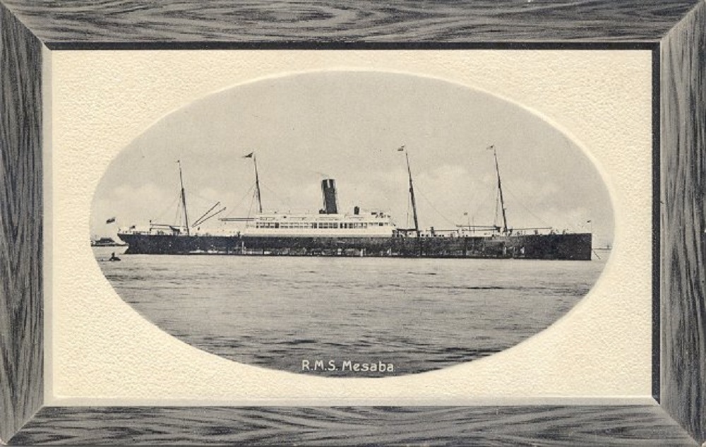
In 1912 the merchant steamship SS Mesaba was crossing the Atlantic and sent a warning radio message to the RMS Titanic. The message was received, but never reached the bridge.
Later that night, the supposedly unsinkable Titanic hit an iceberg and sank on her maiden voyage, taking 1,500 lives and becoming the world’s most infamous shipwreck.
The SS Mesaba continued as a merchant ship over the next six years before being torpedoed whilst in convoy in 1918.
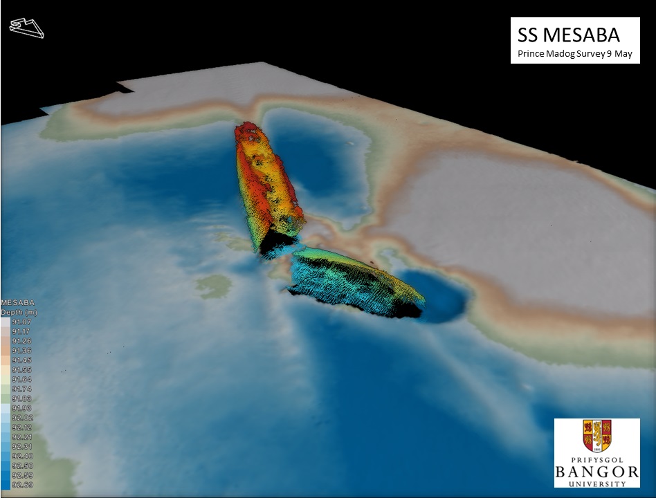
Using state-of-the art multibeam sonar, researchers at Bangor University have finally been able to positively identify the wreck and have revealed her position for the first time.
Dr Innes McCartney of Bangor University said: “Previously we would be able to dive to a few sites a year to visually identify wrecks. The Prince Madog’s unique sonar capabilities has enabled us to develop a relatively low-cost means of examining the wrecks.
“We can connect this back to the historical information without costly physical interaction with each site.
“It should be of key interest to marine scientists, environmental agencies, hydrographers, heritage managers, maritime archaeologists, and historians.”
‘Cost-effective’
The SS Mesaba was one among 273 shipwrecks lying in 7500 square miles of Irish Sea, which were scanned and cross-referenced against the UK Hydrographic Office’s database of wrecks and other sources.
It was thought that 101 wrecks were unidentified, but the number of newly identified wrecks was far higher, as many, the SS Mesaba included, had been wrongly identified in the past.
For the marine archaeologist, multibeam sonar has the potential to be as impactful as the use of aerial photography was for landscape archaeology. Multibeam sonar enables seabed mapping of such detail that superstructure details can be revealed on the sonar images.
Dr Michael Roberts who led the sonar surveys at the University’s School of Ocean Sciences explained: “The expertise and unique resources we have at Bangor University, such as the ‘Prince Madog’ enable us to deliver high quality scientific research in an extremely cost-effective manner.
“Identifying shipwrecks such as those documented in the publication for historical research and environmental impact studies is just one example of this.
“We have also been examining these wreck sites to better understand how objects on the seabed interact with physical and biological processes, which in turn can help scientists support the development and growth of the marine energy sector.”
Support our Nation today
For the price of a cup of coffee a month you can help us create an independent, not-for-profit, national news service for the people of Wales, by the people of Wales.
Get more trusted Welsh news
Choose Nation.Cymru as a preferred source in Google News to see more of our journalism.


Remarkable work Prince Madog, torpedoed amidships; should she find herself between the Ystwyth and the Mawddach there is a lost land to discover…
Now that woud be really interesting!