


Map showing islands off Cardigan Bay may be evidence of lost Cantre’r Gwaelod says Swansea academic
A medieval map showing two island off the coast of Ceredigion and Gwynedd may be evidence of the legendary sunken kingdom of Cantre’r Gwaelod, a Swansea academic has said.
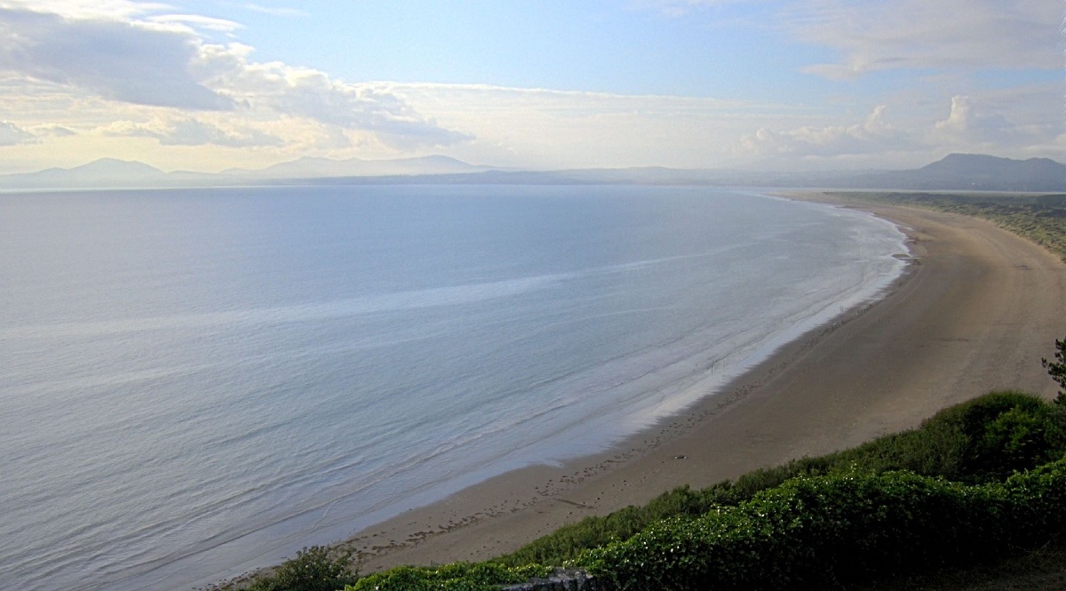
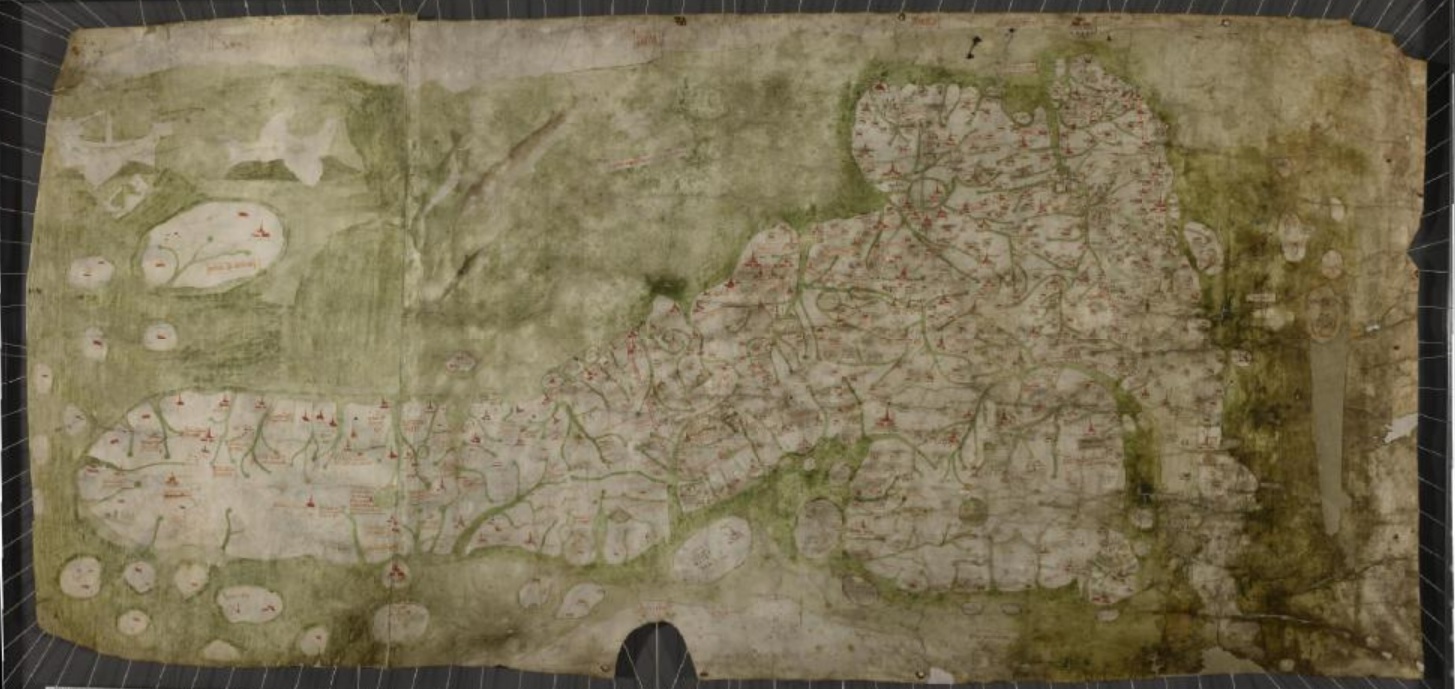
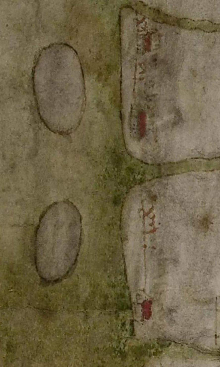
The analysis published in Atlantic Geoscience reveals that one extra island is shown on the Gough Map, between Aberystwyth and Aberdyfi, and the other off Barmouth further north.
Simon Haslett, honorary professor of physical geography at Swansea University worked with David Willis, Jesus Professor of Celtic at the University of Oxford on the discovery.
The tale of Cantre’r Gwaelod tells the story of a land that was flooded after the keeper of the gate that kept out the sea, Seithenyn, went to a party, got drunk and forgot to close it.
Some academics had linked the story to the Old North, suggesting that the myth may have originated in Scotland or Northumbria and travelled down to Wales at a later date.
Simon Haslett and David Willis’ research however suggests that there are two “lost” islands in Cardigan Bay offshore west Wales, United Kingdom.
Their study investigates historical sources, alongside geological and bathymetric evidence, and proposes that post-glacial coastal evolution provides an explanation for the ‘lost’ islands.
They suggest that a rise in sea levels and erosion may have removed the two remaining islands by the 16th century.
“Literary evidence and folklore traditions provide support in that Cardigan Bay is associated with the ‘lost’ lowland of Cantre’r Gwaelod,” they say.
“The model offers potential for further understanding post-glacial evolution of similar lowlands along northwest European coastlines.”
‘Marked’
Simon Haslett said that the map hints that there were some landforms that had been lost out in the shallow waters of Cardigan Bay.
“The Gough Map is extraordinarily accurate considering the surveying tools they would have had at their disposal at that time,” Simon Haslett told the BBC.
“The two islands are clearly marked and may corroborate contemporary accounts of a lost land mentioned in the Black Book of Carmarthen.”
The Gough map, held in the collections of the Bodleian Library at Oxford University, is the earliest surviving complete map of the British Isles, dating from as early as the mid-13th Century.
Simon Haslett added: “I think the evidence for the islands, and possibly therefore the legends connected with them, is in two strands.
“Firstly, coordinates recorded by the Roman cartographer Ptolemy suggest that the coastline at the time may have been some 13km (8 miles) further west than it is today.
“And, secondly, the evidence presented by the Gough Map for the existence of two islands in Cardigan Bay.”
Support our Nation today
For the price of a cup of coffee a month you can help us create an independent, not-for-profit, national news service for the people of Wales, by the people of Wales.
Get more trusted Welsh news
Choose Nation.Cymru as a preferred source in Google News to see more of our journalism.


It is nice to have what one has believed all along confirmed but standing on Sarn Badrig at low tide it does not take much convincing…countless ship wrecks, sunken lands and mysterious causeways, Cantre’r Gwaelod is the stuff of legend no more…the old Welsh Girl carried thousands of cowrie hunters from Barmouth to Shell Island and back for decades, the original Llanbedr bypass, through the east passage that separates the Sarn from the beach she would roll in the swell relieving boarding house guests of their fried breakfast as she went…much to my and George’s amusement and into the beaks… Read more »