


Gale-force gusts forecast for parts of Wales on Friday
Gale-force gusts could hit parts of Wales on Friday, the Met Office has warned.
After a rainy working week, a change in the jet stream – which is a core of winds high up above the Earth’s surface – could spell a wet and windy Friday and weekend for many
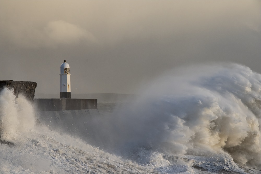
The strongest winds are excepted in coastal regions of southern Wales, Cornwall and Devon and in higher grounds in these areas, such as the Brecon Beacons, Dartmoor and Exmoor.
No weather warnings have been issued at present but the forecaster has advised people to check for updates.
Met Office spokesperson Oli Claydon said: “The key bit really is the winds, it is going to feel notably unsettled and windy as we go through Friday, for a summer period.
“It’s not necessarily unusual, we do get unsettled spells but because of the nature of what’s going on at this time of year it can have its impact, so obviously we’ve got trees in full leaf, we’ve got some schools are starting to break up so we’ve got people on holiday.”
“It’s just different considerations when we see windy spells at this time of year.”
Showery
Thursday is set to be another “showery day” but with rain less widespread than on Wednesday afternoon, and “temperatures getting up to 24C as a high”, Mr Claydon said.
He added: “The real change comes through Thursday night and into Friday, we see an area of low pressure approaching from the south-west bringing some very wet and windy weather, initially to the south-west of the UK in the early hours of Friday and then that spreads north-eastwards across the UK through the day on Friday.
“In terms of wind, the strongest of winds are expected in south-western parts, so coastal regions of southern Wales, Cornwall, Devon and also the higher ground in these regions as well so Dartmoor, Exmoor, the Brecon Beacons, they’re the areas where we are likely to see the strongest of winds where we could see gale-force gusts.”
He said “pretty much everywhere will see rain at some juncture through the day on Friday”, when highs of 23C are expected in south-east England.
He added: “In terms of accumulations, we could see 24-hour totals in the region of 30-50mm, particularly in western parts of the UK, accumulating over 24 hours. So, a pretty unsettled day through Friday and also Saturday.”
Mr Claydon said Sunday will also be “breezy” with “showers quite widely still across the UK”.
“Through Friday to start with, that rain is pushing eastwards through the day so, dry in the morning but that rain moving in by the time we get to the middle of the afternoon,” he added.
“It will dry out for a little period overnight before the showers then reinvigorate through the day on Saturday.
“It’s started to move more into showers by that period so it won’t necessarily be hitting everywhere throughout the day, it will be on and off.”
Support our Nation today
For the price of a cup of coffee a month you can help us create an independent, not-for-profit, national news service for the people of Wales, by the people of Wales.
Get more trusted Welsh news
Choose Nation.Cymru as a preferred source in Google News to see more of our journalism.


Brecon Beacons!!!!!????? Bryniau Brycheiniog please.