


Interactive map shows every campsite in Wales that you can travel to by train
A new interactive map shows every campsite in Wales that you can travel to by train.
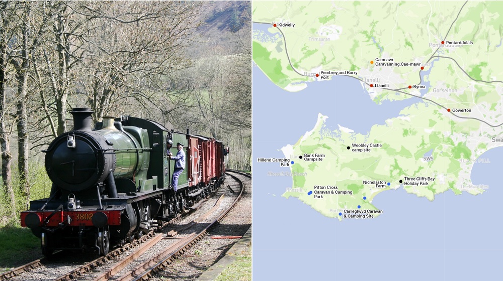
The map shows both campsites in orange that are a quick walk (less than 3 km), black a longer walk (3-10km), blue a day’s walk (10-20km away), and grey a longer trek (over 20km) from a train station.
Rail stations are marked in red. The campsites at different distances and the rail stations can also be toggled on and off by the map user.
The map was created by Will Petty from Hackney, London who said that he collected the data from Open Street Map.
Not very seasonal, but I finally got round to making a map of UK train stations + walkable campsites. Shows campsites that are <3km from stations (i.e. basically next door), and 10-20km away (i.e. very roughly a day’s walk). Useful? https://t.co/fIdVS7GVl9 pic.twitter.com/5dXVo2DxS0
— Will Petty 🌳🌳 (@Microlambert) December 14, 2022
In the current meteorological and political climate, however, perhaps any practical use of the maps will have to wait a few months – until the weather improves and train strikes are resolved.
Support our Nation today
For the price of a cup of coffee a month you can help us create an independent, not-for-profit, national news service for the people of Wales, by the people of Wales.
Get more trusted Welsh news
Choose Nation.Cymru as a preferred source in Google News to see more of our journalism.


