


Met office warns of more rain to come after localised flooding hits parts of south Wales
The Met Office has warned of hazardous driving conditions after heavy rain brought localised flooding to parts of south Wales.
Natural Resources Wales has issued 19 flood warnings and 35 flood alerts due to persistent heavy rain since Wednesday.
Maerdy, in the Rhondda Valley, experienced 82.2mm of rainfall between 9pm on Wednesday and midday today and Nant yr Ysfa in Pontypridd recorded 77.2mm..
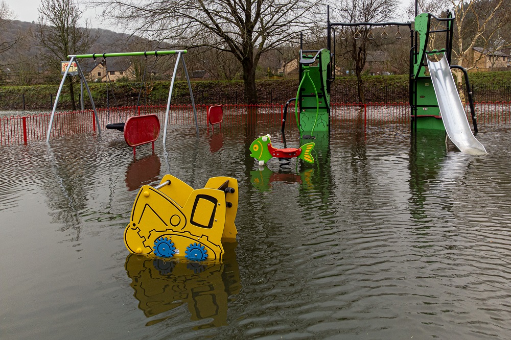
Earlier today, the River Taff burst its banks, flooding a number of parks and walking routes along the Taff trail, including Cardiff’s Bute Park near the city centre, and Taff’s Well Park, which currently lies underwater.
South Wales Fire and Rescue Service said Porth and Pontypridd were the areas worst affected by flooding.
Pontypridd’s popular arts and music venue Clwb y Bont has had to close due to water damage.
Hundreds of properties in Newport have been without power for most of the day, while part of a footpath collapsed into the River Ebbw, leading to its closure by the council.
The River Usk in Powys has also burst, flooding parts of Crickhowell.
Transport for Wales said four railway lines were blocked due to heavy rain flooding the tracks, including Cardiff Central to Bridgend, Pontypridd to Treherbert, Newtown to Shrewsbury and Abercynon to Aberdare.
Take action
Meanwhile, residents in Shropshire and the Mid Wales border in Herefordshire were told to take action to protect their homes, due to flooding being expected in Ironbridge and Jackfield, and five other areas including the River Severn at Frankwell, the River Severn at the Showground and The Quarry, the River Teme at Stanford Bridge, the River Vyrnwy at Maesbrook and the River Vyrnwy at Melverley.
The wet and windy conditions are likely to continue on through Saturday and Sunday and into next week, bringing with them renewed risk of flooding in areas which have already seen heavy rainfall.
Stephen Dixon, spokesperson for the Met Office, said: “The heaviest of the rain has largely moved away eastwards now towards the north of the UK, bringing rain particularly to Scotland later this afternoon.
“However, showers remain possible for large parts of the UK in what will remain a largely unsettled day.
“The low pressure has also triggered a yellow wind warning for Northern Ireland and the far north of Wales and north-west England, and that’s in force from 3pm today until 3am tomorrow morning.
“Within that warning area, you can see gusts of up to 70mph across some exposed coasts, but possibly gusts of around 50mph inland as well.”
He added: “Friday is likely to be unsettled as well but is mainly a prelude to another band of rain which is going to cause showers throughout most of the UK on Saturday and into Sunday morning.
“On Saturday, the rain is looking likely to be heaviest in the west of Wales and the South West as well, with some areas seeing in excess of 50mm.
“We will be keeping an eye on that because some of that rain will be falling on already saturated ground.”
Significant rainfall
Andy Wall, from Natural Resources Wales, said: “We’ve had a period of significant rainfall over the last 24 hours, which follows on from a prolonged period of very unsettled weather across most of Wales over the last month.
“We had four inches of rain, 100mm, on top of the Brecon Beacons last night and we’ve seen rivers respond to that.
“There’s been widespread travel disruption with flooding of low-lying land and roads.
“We’ve got some isolated reports of property flooding, which is still being investigated.
“Fortunately, we’ve been spared some of the worst which could have happened if the rainfall had been heavier. But overall, it’s a difficult picture across Wales.
“Given the rainfall being forecast by the Met Office into the weekend, we would expect to see rivers full again, and are quite likely to see flooding onto floodplains, farmland, minor roads, and we could see some property flooding, particularly in isolated communities in low-lying areas.”
Mr Wall said in recent years the country has seen “an increased frequency of severe weather” due to climate change, including long periods of drought as well as prolonged periods of wet weather.
Support our Nation today
For the price of a cup of coffee a month you can help us create an independent, not-for-profit, national news service for the people of Wales, by the people of Wales.
Get more trusted Welsh news
Choose Nation.Cymru as a preferred source in Google News to see more of our journalism.


