


New interactive live map launched for rail travellers
A brand new live digital map has been launched showing customers exactly where their train is at any given time.
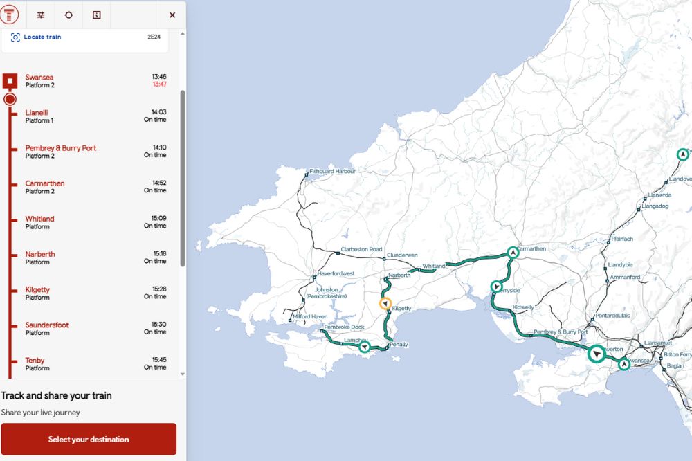
The map shows the location of every train on the Transport for Wales (TfW) network, allowing customers to view their journey in real time and see the expected arrival time at each station on its route.
TfW have partnered with rail technology innovator, Signalbox to offer the interactive map which can detect the train smartphone users are on, share your live arrival time with friends and family or search for any other train.
Customer Information Strategy Manager for TfW, Teleri Evans, said the rail operator is “passionate” about using new technology to improve customer experience.
Colour coded
She said: “We know our customers want the latest information made available to them while travelling to feel confident that they know what’s going on.
“Whether you’re sat on a train and want to get your bearings or are waiting at a station and wondering where your train is, the right information really can give you peace of mind.
“This fantastic live digital map shows exactly where you are and also any other trains you might be looking to connect to.”
Signalbox uses live data to estimate the location of trains as they pass key points on the tracks. And later this year the technology will incorporate GPS data from trains to provide an even more accurate picture of where the train is.
Each train is colour coded depending on whether it is running on time, slightly delayed or delayed by more than 10 minutes. You can also see what that delay might mean for arrival times at stations further down the line.
Toby Webb, Founder of Signalbox said: “We know that travellers are reassured by seeing the progress of their journey in real time on a map, and find it useful to share with friends and family.
“Until now, rail has lagged behind other industries in offering interactive live maps for its passengers. So it’s been exciting to work with Transport for Wales to deliver this new tool that incorporates the best bits of Signalbox technology to detect, map and share trains in Wales.”
Support our Nation today
For the price of a cup of coffee a month you can help us create an independent, not-for-profit, national news service for the people of Wales, by the people of Wales.
Get more trusted Welsh news
Choose Nation.Cymru as a preferred source in Google News to see more of our journalism.


No link?
Oops! The link should be working now.
What a nice idea. All one needs to do is download it, fire it up and then discover that your TFW train has been cancelled. Actually, like the Carmarthen Aberystwyth line, the map is not currently available for use/download. I have spent a while trying to find it. The currently available app on Google Apps appears to be the old one which, to be fair, does give some information about where your train might be.
This link is working Peter.https://tfw.signalbox.io/[email protected],-4.06383,7.1Z
Carmarthen to Aberystwyth restoration would do more than Wales at less cost than a few miles of HS2 that are paying for for England
UK my arse
It beats me how GPS technology like this isn’t already in use, not only for the benefit of passengers but for rail line worker’s safety too. Remember those workers struck by a high speed train near Port Talbot a few years ago! GPS is basic technology these days and should be able to tell anyone where a train is within 10 meters.