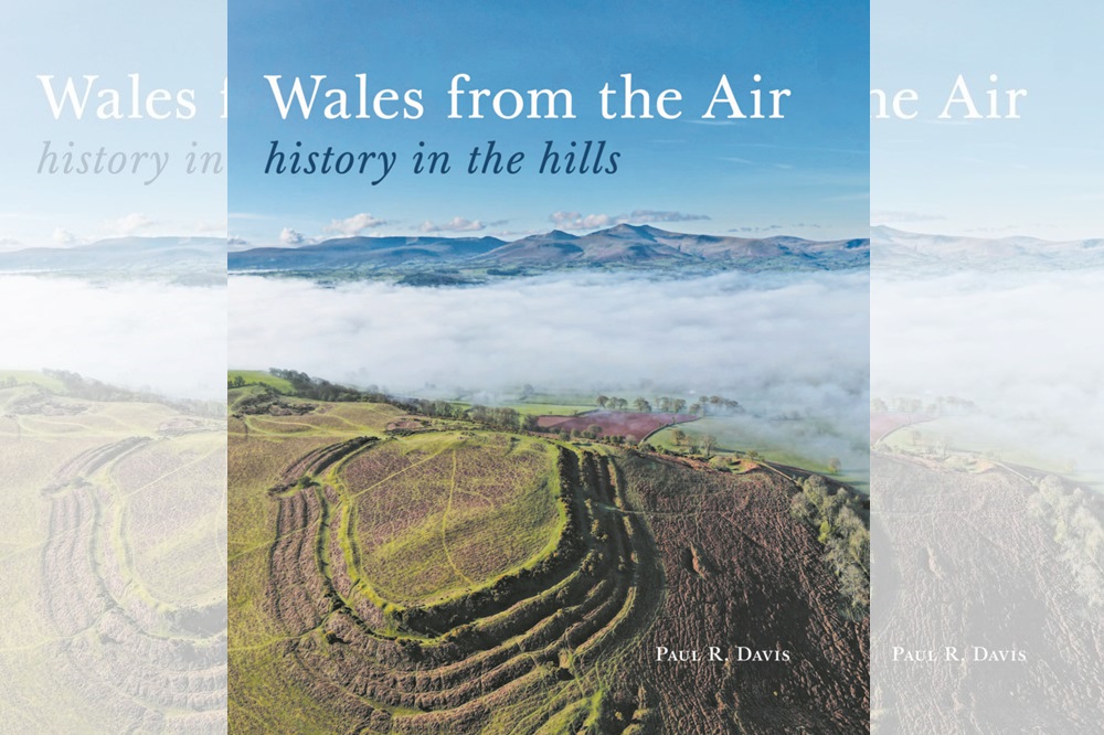
Book review: Wales from the Air by Paul R. Davis
Jon Gower
There was a time when many a house and farmhouse in Wales sported an aerial photograph of the place on a wall inside.
They were taken by firms such as Aerofilms, the UK’s first established commercial aerial photography company, established in 1919 by a former RAF observer, Francis Wills and pioneering aviator Claude Grahame White, who made the first every night flight.
They and their successors flew in small planes over the land to offer an unfamiliar bird’s eye view of a very familiar building. This book does the same for a whole country.
That said, what used to be called a bird’s eye view might one day be replaced by the term a drone’s eye view, as this versatile bit of kit is now used for an increasingly wider range of applications, from surveying buildings to goods delivery.
Detective work
For archaeologists such as Paul Davis, drone-enabled imagery has been a veritable game-changer, taking over from what has been a century’s worth of photography from aeroplanes.
Davis’ work involves making sense of landscape features that might otherwise remain undetected but can now do so much more cheaply.
It involves a lot of detective work, and often requires the sun to be at the right angle to fully bring out the shadows of bumps and shapes in the terrain.
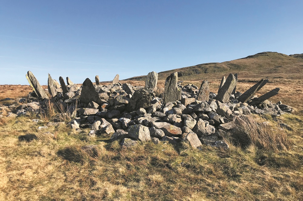
Banc Du enclosure near Maenclochog is a good example, this being the first recognised Neolithic enclosure in Wales.
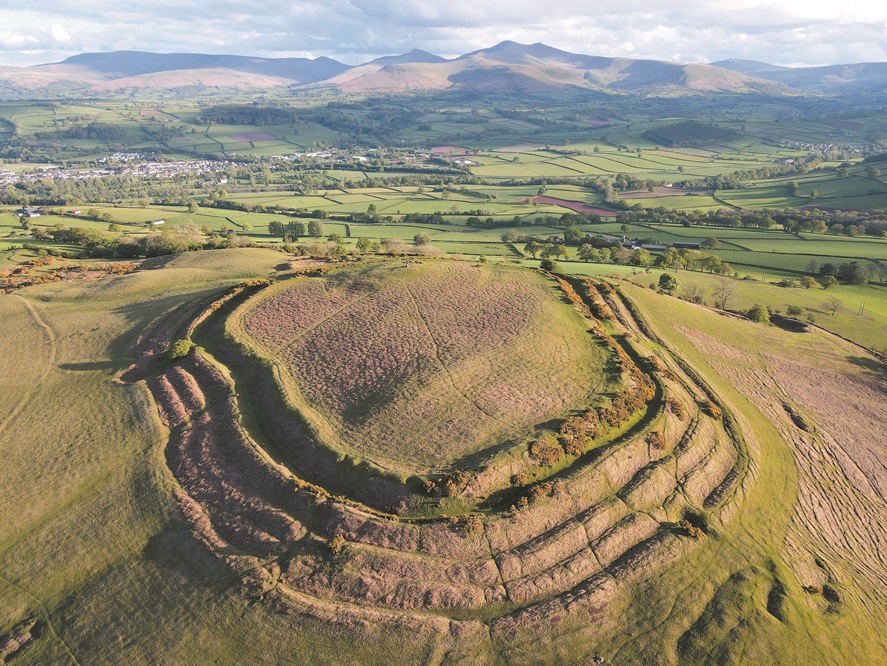
A photo taken on a late April evening shows banks and ditches, inner and outer enclosures which would be invisible to the observer’s eye at ground level.
Davis has clearly put in a huge amount of effort to be in the right place at the right time to send his drone aloft.
Early history
This beautifully presented book offers an arresting and constantly informative overview of the early history of this country.
It runs from late Prehistoric times up to the start of the Early Modern period, taking in castle ruins and abandoned monasteries, ancient burial mounds and striking stone circles.
It surveys commanding hillforts, details extensive boundary dykes and captures deserted farmsteads.
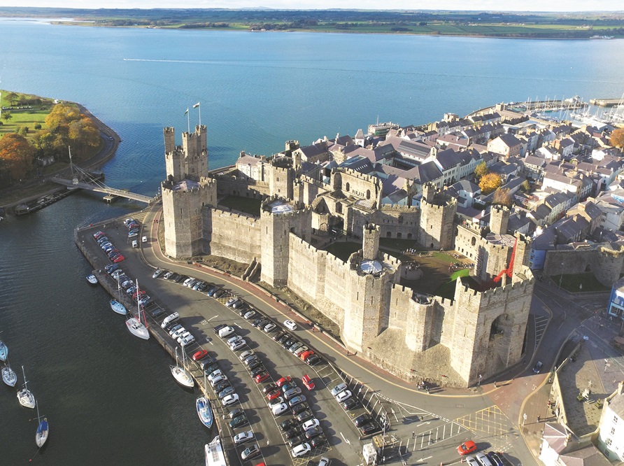
Even familiar views gain from the perspective of height, such as the shape of the castellated walls of Caernarfon castle, which serves to underline how they really were built to last.
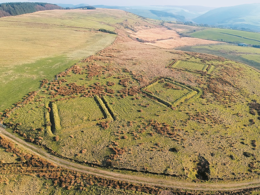
One of the most unexpected locations is the mysterious set of square earthworks at Cefn Morfudd near Neath, which might be Roman practice camps.
A more intriguing possibility, mooted by Davis, is that they could be medieval or post-medieval ‘bee gardens’ used for producing honey in the hills.
The banks and ditches – made visible by photographing this uplands site in the right light – might have been used to keep livestock such as cattle away from delicate hives made of straw, allowing the bees to feed off the purple heather thereabouts.
There are plenty of Roman remains, not least ‘the best preserved Roman military landscape in Wales’ at Tomen-y-Mur near Trawsfynydd.
This includes the remains of roads, the rectangular outline of a fort, marchignb camps and practice camps, an aqueduct, an amphitheatre, burial mounds and a bath house.
In the case of bathing we find ourselves fully awash with interesting facts, because this activity was a key component of the Roman way of life.
After disrobing in a special room, the patron would progress via a tepidarium, or warm room to the caldarium or hot room.
All this would cause someone to sweat such that ‘servants could massage scented oil into the skin and remove the slimy residue with a skilful sweep of a blunt metal blade.’
Then a quick dip in the chill waters of the frigidarium would close up the pores as it the freezing dip was a shock to the skin.
Castles
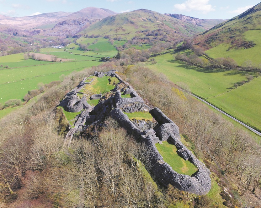
As you’d expect there are quite a few castles in this book. Those of the Welsh princes include Castell y Bere, perched like a raven’s nest above the Dysynni valley.
The medieval castle of Deganwy commandeers a rock high above Llandudno, with the remains of walls on the rock’s twin humps.
There’s a very early Norman motte and bailey castle built just over the border in Ewyas Harold, constructed to challenge Welsh supremacy.
Religious buildings are represented by such places as Neath Abbey, once the fairest in all of Wales.
The ground plan of a site which changed into an industrial one with the coming of iron-working is rendered very clear from the drone’s very high vantage point.
Once again the tiny, Herefordshire-based Logaston Press has come up trumps, producing another beautifully designed book.
So hats off to designer Richard Wheeler on another job very well done. He’s helped produce what might be considered to be an atlas of Wales from on high, revealing something new, or seen from a new angle, on pretty much every page.
Wales from the Air: history in the hills by Paul R. Davis is published by Logaston Press and is available from all good bookshops.
Support our Nation today
For the price of a cup of coffee a month you can help us create an independent, not-for-profit, national news service for the people of Wales, by the people of Wales.


The fourth book of this title…
This one looks like it continues in the vein of Chris Musson…
A must for any library…