


It’s ‘official’ Wales has taken the Midlands
A map showing Wales as part of the west Midlands has caused much amusement online.
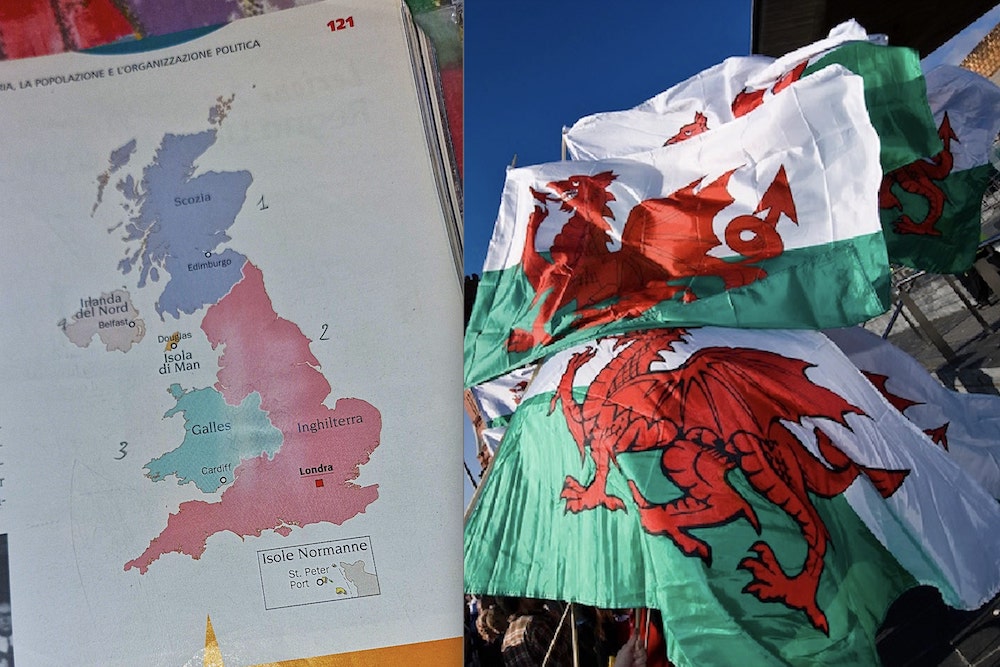
A post on the X account Terrible Maps shows what appears to be a map of the UK from a schoolbook in Italy, which informs pupils that Wales is in fact bigger than we and they had first thought.
The map that would no doubt very much please Owain Glyndwr shows the all new XXL Wales has caused lots of amusement on social media – and some hilarious comments too…
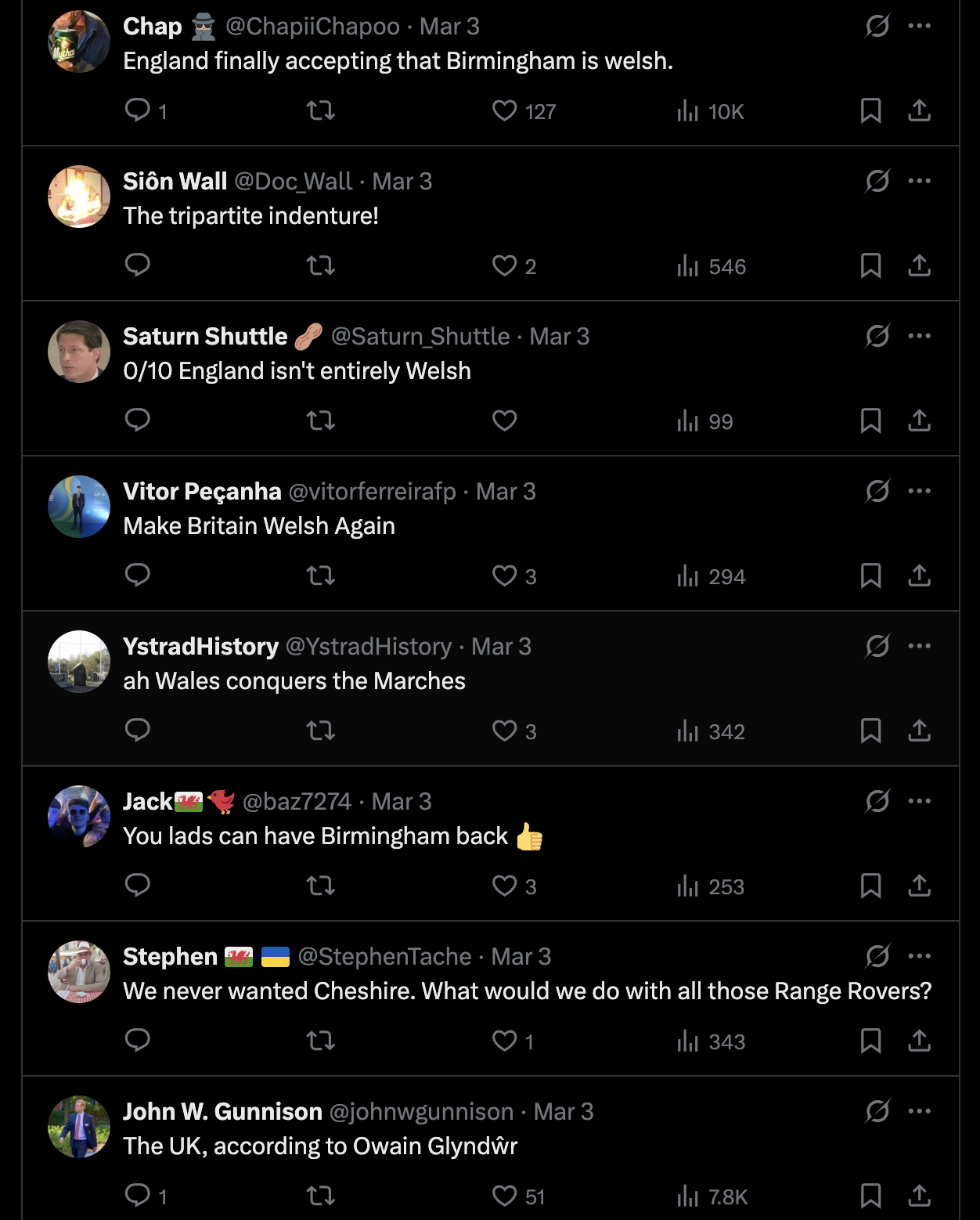
One X user Damian Counsell exclaimned: “THE WELSH HORDES HAVE TAKEN THE BULL RING. REPEAT: THE WELSH HORDES HAVE TAKEN THE BULL RING. VILLA PARK IS FULL OF SHEEP. OUR BALTI SUPPLIES ARE EXHAUSTED. SEND AID.”
Another chipped in with: “Wales can have Wolverhampton for free”, while another added: “Birmingham fell in days. We are trying to regroup at Leicester to stop the endless Welsh tide. Pray for us.”
Here are the best of the rest:

Support our Nation today
For the price of a cup of coffee a month you can help us create an independent, not-for-profit, national news service for the people of Wales, by the people of Wales.


Dim diolch
Oh, I dunno! What about those areas around Croesoswallt where so many farms, lanes and villages still have Welsh names? I now live not too far from that part of the world,
And consider as well that chunk of south-west Herefordshire which the English called ‘Archenfield’ but the proto-Welsh once knew as ‘Erging’? Take a look at village names surviving in that corner of Herefordshire: for instance, Llanveynoe and Bagwyllidiart come to mind. Once, long ago, I used to live quite near those parts.
Actually Glyndwr’s plan was precisely this. He allied with the Percys and a French faction. They would divide up England so the Percys ruled the North, the French gaction London & SE, while Wales enlarged to take the area shown on this map and quite a lot more. Unfortunately the French faction didn’t follow through so Glyndwr did not succeed.
The reality is the reverse…
Witness YouGov polling, for example. And don’t get me started on reservoirs!
To be fair this is probably the future because the alternative for the English borderlands under the inevitable regional devolution with devomax in England is to be run from Birmingham.
The map shows the extent of the lands when Wroxeter was the capital of Powys. It was thus the last time the Italians were here in the 5th century.
Why would we want anything to do with Birmingham or Wolverhampton some parts of Hereford used to belong to us anyway