


OS Maps adds first ever hazard reporting tool for walkers
Stephen Price
OS Maps – the UK’s most popular outdoor digital navigation tool, developed by Ordnance Survey – has taken a significant step towards helping walkers avoid hazards on their journeys with a new live hazard reporting tool.
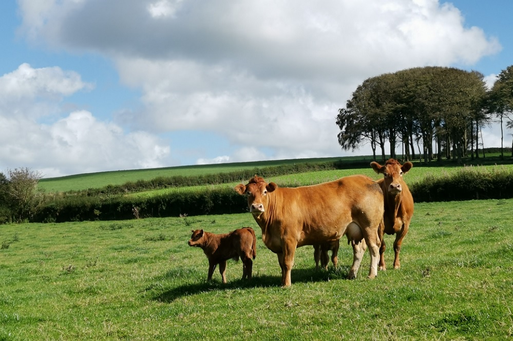
Nothing ruins a beautiful walk in the countryside faster than unexpected obstacles – whether it’s boggy ground that can leave entire families with sopping wet socks hopping around hopelessly trying to retrieve wellies, agroup of angry-looking cows staring you down 50 metres away on the field edge pathway ahead (giving your dog the jitters) or an out-of-control tower of brambles confronting you five minutes after you’d followed a clearly marked footpath sign, with thorns tearing your arms and legs so badly you’re forced backwards on a two-mile detour.
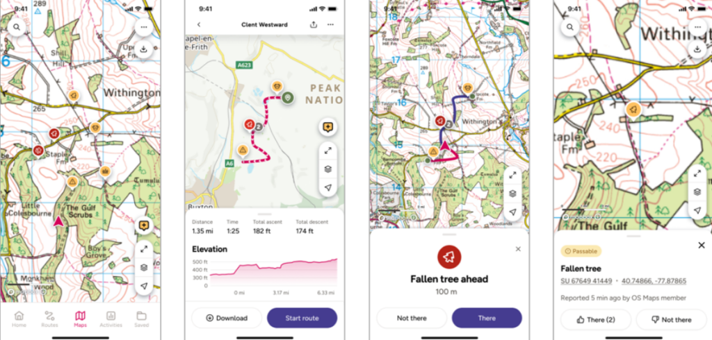
OS Maps has introduced its new Community Alerts feature, a live hazard reporting tool into the app that is a first of its kind for outdoor activities.
Obstacles
Like hazard reporting tools motorists use in traffic apps to report congestion and accidents on out roads, it relies on the OS Maps community to self-police it.
Users can report hazards they encounter to the app, whether that’s flooding, cows in a field, public paths which have been deliberately obstructed by a landowner, or any others.
They report whether the obstacle is passable or non-passable and upload it directly to the app, where it will show up on screen for other walkers who are viewing a route to see (yellow icon for passable, red for impassable).
When users are following a route, obstacles and hazards are visible on the map so they can see if the path is blocked.
Later if somebody else visits the same location, and the obstacle is no longer there, they can report the problem has disappeared in the app and it will be removed.
Self policing
OS Maps Managing Director, Nick Giles, said: “This is a huge step forward for OS Maps and the millions of people in Britain who use it.
“Previously the only hazard reports we could do was ask people to post photos of issues they find on a route and then write a review underneath – which is only useful if someone goes on to read the reviews.
“Now, OS Maps users can toggle hazard warnings on and off. When selected, they pop up as yellow icons on the map if passable and red icons if impassable, to warn them of issues ahead.
“All different kinds of hazards can be reported – whether it’s no visible footpaths, trees over a path, floods, overgrowing vegetation or anything else – it is all on there. Once reported, the hazard will be visible on the map while you are following a route to help you plan.”
The system is self-policing and reliant on the OS Maps community and outdoor enthusiasts to make it work.
The potential the tool has for keeping people safer and away from danger is enormous, particularly around accident blackspots where slips and trips are commonplace.
Nick added: “This is a major evolution and demonstrates how technology is enhancing the outdoor experience in Britain.
“As ever, we aim to make the outdoors accessible and safe for everyone, and this hazard reporting tool does just that.
“Just open the app and the icons will forewarn you of any potential hazards, either if you’re viewing an existing route in OS Maps, or just generally looking at a map on the screen.”
Download OS Maps app from the Apple & Google Play app stores, or find out more information on the OS shop.
Support our Nation today
For the price of a cup of coffee a month you can help us create an independent, not-for-profit, national news service for the people of Wales, by the people of Wales.
Get more trusted Welsh news
Choose Nation.Cymru as a preferred source in Google News to see more of our journalism.


This is a really sensible and useful feature. Well done.
I would hope that the facility is further developed to automatically report the hazard to the relevant highway authority who have the responsibility to ensure that land owners remove hazards.
While this a good idea in principle, surely hazards should be verified before they appear on the map
Many hazards are transitory – and conditions change – what is an impassable stream after heavy rain may be a trickle on another day
Looking at an open area of moorland high in the Brecon Beacons someone has noted a cattle hazard. Given that cattle are free to roam they are unlikely to be in the same spot some weeks later
Who is going to check?