

Teithiau Tom: Under the shadow of the hillside at Brynmawr and Nantyglo
Tom Maloney
A few years ago, a road sign directed me to the Nantylgo Roundhouses. I had a little time to spare and thought it would be interesting to stop off and take a look at them.
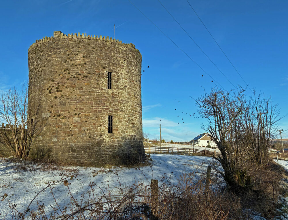
Well, I am not sure what I expected to find really, certainly not a circular castle, resembling a stalwart, if stubby, stone built coastal ‘Martello Tower’.
Even though I had a feeling that this was a heritage attraction that was seldom seen, my interest was heightened and I promised myself that I would return when I had more time.
As is so often with good intentions, my subsequent visits were much the same very brief affairs, I was always going somewhere else … that is until now. It was time to make good on the promise!
But … before putting on my boots to explore, I needed a little inspiration to guide my way and after just a little internet research I came across a ‘The Joseph Bailey Trail’ published by Blaenau Gwent County Borough Council.
It is one of a series of walks published by the local authority and this gave me the key to unlock a new journey of interest.
Starting at the Market Hall in Brynmawr, the route essentially follows old tramroads, railway lines and side roads to Nantyglo, but I just knew that it would turn out to be so much more than this. In the end I made four visits with Storm Goretti in between!
There is nothing like getting to know a place on foot. Ambling along allows you to have the time to take things in and to follow inclinations.
It soon became noticeable how closely Nantyglo and Brynmawr embrace each other. They seem to be so much more separate when driving.
Over time, most places will see change, some more than others, but there are usually reminders of what has gone before that will talk to you of bygone days.
Unmistakable, precise railway architecture of dressed stone, mottled with age and grand arches infilled with row upon row of faded blue and red engineering bricks, garlanded with spreading ivy tell their story surrounded by the modern big stores.
Asda and Lidl are amongst the ‘new kids in town’ but the railway was here before.
And … everywhere that you walk, there is the constant, seemingly watchful presence of the bare hill ‘Mulfran’, meaning ‘cormorant’ translated from the Welsh, though this was a name unfamiliar to one local that I met. For him, it was better known as ‘The Grouse’.
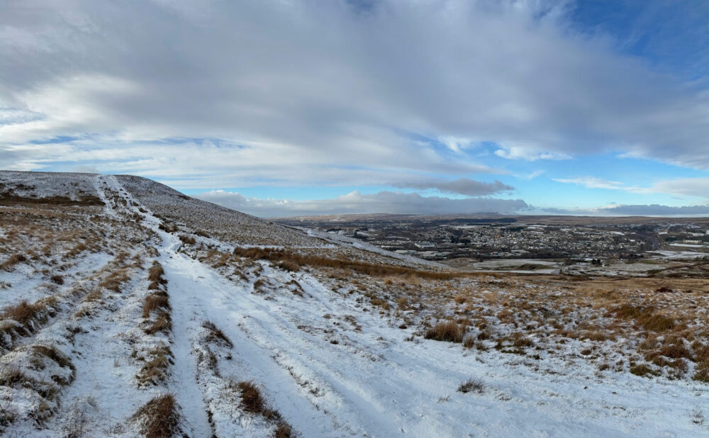
To get a full understanding of place there was nothing for it but to get to the top of this brooding hillside.
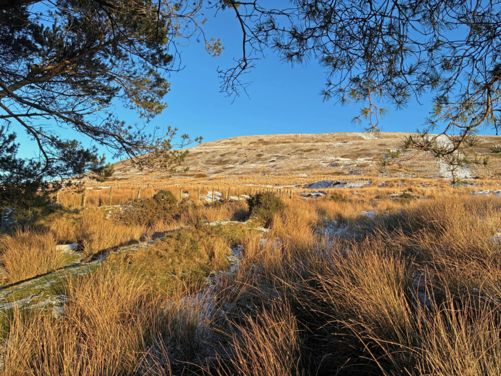
Mulfran, is not the biggest of hills that is for sure, but it neither is it small and it should most definitely not be underestimated.
Looking up from Brynmawr town centre the hillside is steep and sheer, but the approach from the Blaenafon side following the ridge from Mynydd Coety is gentler on the legs.
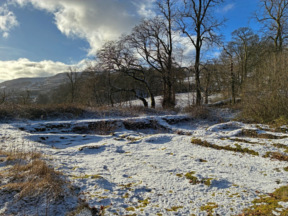
From a distance, Mulfran appears bare, but in reality, it is blanketed in ‘cwtch’ grass, rising from a sea of sparkling, frosty, crystalised snow just now, well at the time of writing. Perhaps, not everyone’s favourite, but beautiful in the glow of the setting sun.
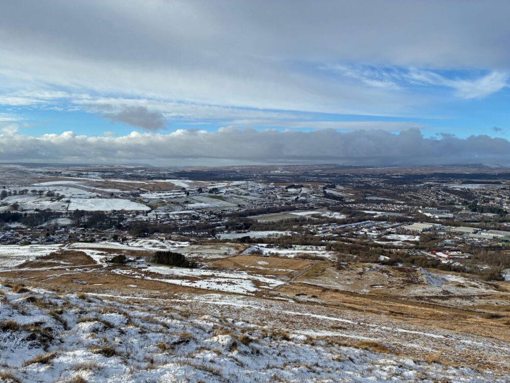
Accompanied by a short history of Brynmawr, produced by ‘The Brynmawr Museum and Historical Society’ I gazed over an undulating patchwork of history sharply defined by the wintry weather.
Even with the bite of the cold on my hands, I could not have had a better place to read about what I could see directly in front of me and it was iron that forged the landscape below.
‘The growth of Brynmawr depended on the work available nearby. In 1794 the Clydach railroad opened, this provided a route to the canal at Gilwern along which coal dug in this area could be transported to the larger towns of Brecon and South towards Newport but it was the iron works at Nant y Glo opening in 1795 that was the catalyst. Originally started by Harford it became a success under the leadership of Joseph and Crawshay Bailey.
‘ The railway arrived in 1862 and the town became a very important rail centre.’
The history gives the original name of the area as ‘Waen Helygen’ meaning ‘Willow Moor’ and the name ‘Brynmawr’ or ‘Big Hill’ came into common usage after one of the farms on the moor, though perhaps this farm may in turn have owed its name to ‘Mulfran’, on which I stood, as it was and still is such a dominant feature.
Nantyglo – Stream of Coal
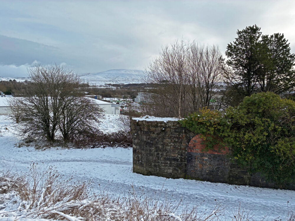
The Nantyglo Roundhouses are a visible vestige of troubled times that can be made out from the summit of the hillside.
‘The Nantyglo Roundhouse complex is a unique relic of the Industrial Revolution. It was built in about 1816 by Joseph and Crawshay Bailey, the Ironmasters of the Nantyglo Ironworks, as a defended refuge against armed revolt by their workforce. In effect, it was the last private castle built in Britain.
The site is privately owned but can be viewed from the road.’
Whilst the trees are bare in the winter months is a good time to view the stark lines of the towers with their dark, narrow windows, perhaps designed to impede forced entry or perhaps with the firing of muskets in mind.
So strange indeed, to think that such a strong fortification was needed as a defence against armed revolt by your own workforce, but these were very different days.
The battle of Waterloo would have been fresh in the minds of everyone and in all likelihood would have affected ways of thinking.
Rather like feudal lords, the ironmasters may well have been sending a powerful message of menace and intimidation, to communicate ‘who was boss’, a message that is all but drowned out today by the echoing cackle and squawking of crows in flight!
Above all, these circular walls remind us that the rights we all enjoy today did not come easily.
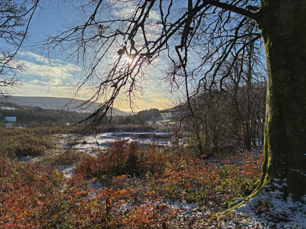
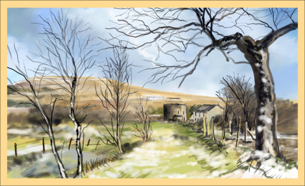
Immediately below the roundhouse complex lie the ruins of ‘Ty Mawr, The Great House’. In its day this was the grand mansion of the Bailey family, but it is seemingly a forgotten place today, neglected over many years.
There is still a sense of grandeur about the woodland setting, but surprisingly, abandoned, rusted mattress springs, discarded plastic bottles and cans litter the surroundings.
Again, it is impossible to wander here without thinking of the inequality of life during the Industrial Revolution and maybe it is right that Ty Mawr remains neglected, though I have to admit my thoughts are conflicted about this.
From the footprint of the remaining foundations, you can imagine a spacious, luxurious home with many well-appointed rooms and probably a substantial cellar to boot, so different from cramped, unhygienic conditions that the iron workers would have endured.
Once more, no doubt, sending a clear message in its design that this was a seat of power where the elite people lived.
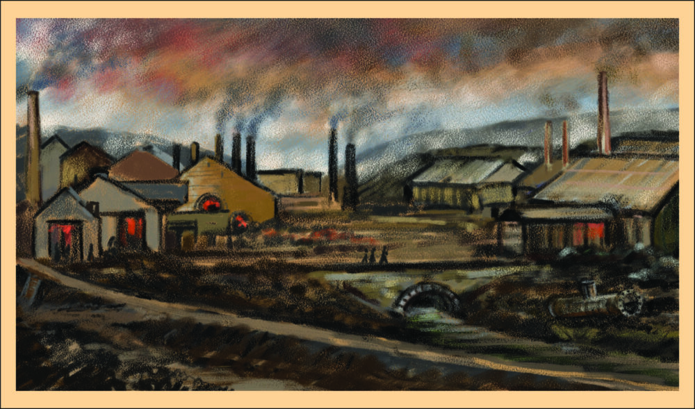
And … what of Nantyglo Ironworks?
Many thanks to the ‘The Joseph Baily Trail’, which reveals that the ironworks was no more than a stone’s throw from the Ty Mawr.
The ironmasters were able to keep a watchful eye on their business.
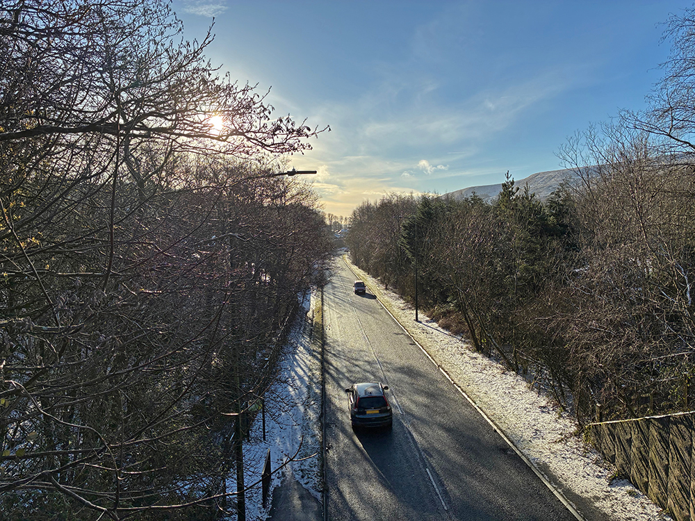
Standing on the nearby road bridge over the A467 allows a panoramic view not only of the valley, but of the site where the furnaces glowed bright and red and where the chimneys belched their acrid smoke. You would hardly know it today!
Just taking the time to stroll around this landscape, stopping here and there to take things in and to wonder made for an interesting and thought provoking few days of walking.
It is so easy to bypass places like Brynmawr and Nantglo and continue to the Heads of the Valleys Road, but there is significant Welsh history in this landscape.
No money needed, just have time to spend.
Further Information
Parking – Parking at Nantyglo, especially near the Round Houses is limited, but there are plenty of places to park in Brynmawr.
Nantyglo Roundhouses – The site is privately owned but can be viewed from the road.
Mynydd Mulfran – Although Mulfran is not the biggest of hills, it has a very steep side and the terrain can be very boggy. Approach walking here with caution:
- Check the weather forecast;
- Wear good outdoor clothing and boots;
- Make sure that your phone is fully charged and let someone know where you are walking.
Internet Links:
Brynmawr Museum and Historical Society – ‘History of Brynmawr’
Support our Nation today
For the price of a cup of coffee a month you can help us create an independent, not-for-profit, national news service for the people of Wales, by the people of Wales.


My thinking is that ‘cormorant’ is an unlikely name for an inland Welsh hill – inland cormorants are a more recent thing – perhaps it was moelfran. Moel is a common hill name meaning a bald hill, plus bran/Fran (crow) as in Cwmbran?
Many thanks for the reply. I went through a very similar thinking process, it seems such an unlikely name where Moel would make an excellent fit. Welsh names can be just perfect and at other times a bit of a puzzle. I think that’s why I like them so much. I have been wondering if the profile of the mountain led to its name.