
Long-running dispute over access to mountainside returns to the spotlight
Anthony Lewis Local Democracy Reporter
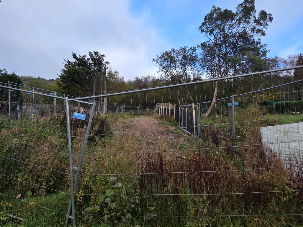
A long-running dispute over access to the mountainside in the Rhondda is set to return to the spotlight, with the planning committee set to consider a retrospective application on adjoining land.
The planning application at Ger Y Coed off Vicarage Terrace seeks permission for crushed aggregate hardstanding, fencing and the change of use of land to residential garden forming part of the property’s curtilage.
Council planning officers are recommending approval, subject to conditions but it has attracted 61 individual objections with the committee report also recording objections from Senedd Members Heledd Fychan and Andrew RT Davies as well as former Senedd Member Rhys Ab Owen.
The application is the latest chapter in the local controversy over access to Cwmparc Forest, dubbed “Gategate” by campaigners.
The council report confirms that a lane running between the application site and the main dwelling at Ger Y Coed has been classified as highway by the local authority.
It also refers to gates previously erected in the area which were subsequently removed, and to a separate application seeking to register a public right of way.
Local councillor and Open Spaces Society director Richard Clarke, who objected to the scheme before being elected as a ward councillor, argues that the planning issues now extend beyond the continuing rights-of-way dispute.
The application site lies outside the Treorchy settlement boundary and within the Rhondda Fawr Northern Cwm and Slopes Special Landscape Area.
Cllr Clarke argues that the combination of hardstanding, substantial fencing, gates and enclosure amounts to the gradual domesticisation of previously open land and harms the visual character of the transition between Cwmparc and the mountainside.
He says: “The line on the Local Development Plan may stay exactly where it is, but the domestic development on the ground keeps moving beyond it.”
His argument is that while neither being outside the settlement boundary nor being within a Special Landscape Area automatically prevents development, councillors must decide what practical significance those protections have if land beyond the boundary is progressively incorporated into residential use.
He says his central question to the committee is “Where does it stop?”
The planning objections centre on the cumulative effect of hardstanding, substantial fencing, gates and other domestic features in a sensitive landscape location.
Objectors have raised concerns about inappropriate materials and engineering works, the scale and appearance of the fencing, countryside encroachment and extending residential curtilage beyond the settlement boundary.
Cllr Clarke’s case is set to be that committee members can assess those features together and reach their own planning judgement about whether they cause unacceptable harm to visual amenity and rural character.
There are also questions over the report’s characterisation of the proposal as a logical extension of existing residential garden.
The council report describes Ger Y Coed as a large detached dwelling and records a highway running between the application site and the main dwelling.
Cllr Clarke is asking officers to clarify the relationship between the application land and the existing residential curtilage of the two properties at 1 an 2 Ger Y Coed, before committee members determine the application.
Documents released by Natural Resources Wales under environmental information legislation reveal a further dimension, Cllr Clarke says.
Natural Resources Wales confirmed that while its planning team held no correspondence from the applicant concerning the planning application itself, its land management team held correspondence from the applicant concerning the land subject to the application.
In an email dated June 3, 2025, the applicant described plans to purchase the neighbouring plot and then apply for the claimed right of way to be moved from its existing position onto that land.
The correspondence also sought Natural Resources Wales’ agreement to use the land for a bridleway and said the proposed solution would maintain the security and privacy of the home while getting people “back onto the mountain.”
In it the applicant says that they believe this is a very good solution that has no net impact on the forestry, keeps their privacy and gets people back onto the mountain.
It says they have been working extensively with RCT Council on providing alternative access to Cwmparc Forestry, whilst seeking to maintain the security of their home.
It adds that they are in late stage discussions with the owner of the plot of land next to theirs to purchase this land, then to apply for the claimed right of way to be moved from the current position to the newly acquired plot of land.
It says that attached to the proposed plot of land is a charge to the benefit of NRW/the Welsh Government which states that the land will not be used for any purpose other than agriculture, forestry or garden purposes.
On the basis that they are looking to move the point of access rather than create a new one, which still exits onto the forestry road before the horse step and forestry gate, the applicants say that they hope that NRW will be amenable to allowing them to use the land for the purpose of putting in place a bridleway.
It says their intention is to gate the area such that a horse step is the only open access and that whilst a wider gate will be present this will be locked to the public.
But, Cllr Clarke said that the current planning application is for hardstanding, fencing and the change of use of land to residential garden/curtilage.
Cllr Clarke says this does not mean the planning committee should determine the separate rights-of-way dispute, but argues that councillors should be aware of the correspondence when considering the nature and proposed use of the land.
Despite the objections, planning officers have concluded that the proposal would not result in unacceptable harm to the character and appearance of the area, residential amenity, highway safety, flood risk and drainage interests, biodiversity or ecology.
The report says the development accords with policies AW5, AW6, AW7, AW8, AW10 and NSA25 of the Rhondda Cynon Taf Local Development Plan and recommends approval subject to conditions.
Cllr Clarke is urging committee members to reach a different planning judgement, principally on visual amenity, the scale and appearance of the fencing and hardstanding, countryside encroachment and the erosion of the rural character of the settlement edge.
He said his message to councillors is set to be: “Officers have reached one planning judgement. Members are entitled to reach another.”
The application is due to go before the planning committee on Thursday, November 5.
Support our Nation today
For the price of a cup of coffee a month you can help us create an independent, not-for-profit, national news service for the people of Wales, by the people of Wales.
Get more trusted Welsh news
Choose Nation.Cymru as a preferred source in Google News to see more of our journalism.