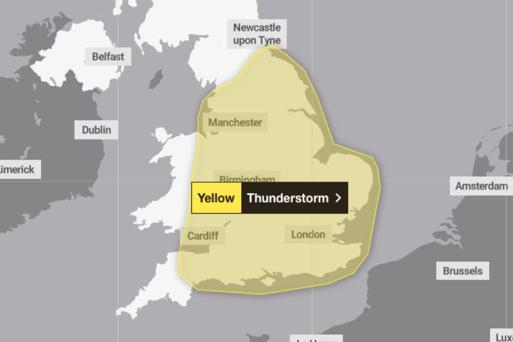
Met Office issues thunderstorm warning

The Met Office has issued a yellow weather warning for heavy rain and thunderstorms for parts of Wales towards the end of the week.
The warning covers the eastern half of the country and will remain in place from 12:00 – 11:59 on Thursday (August 1).
Heaving showers are expected in some areas with 70-90mm of rain possible.
Forecasters have warned the heavy downpours could lead to sudden flooding and disruption with difficult driving conditions and some road closures.
Where flooding or lightning strikes occur, there is a chance of delays and some cancellations to train and bus services.
The Met Office says there is a slight chance that power cuts could occur and other services to some homes and businesses could be lost.
It comes following a short heatwave which has seen temperatures reach over 27 degrees in parts of mid and south Wales.

Disruption
It’s expected to feel even hotter on Tuesday (July 30) with a possible high of 29 degrees before the warm snap breaks on Thursday.
Met Office deputy chief meteorologist David Oliver said: “The heaviest showers on Thursday could result in 20-30mm of rain within an hour, with daily totals possibly reaching as high as 90mm if multiple showers impact the same location. Lightning and hail present additional hazards, with disruption likely for some.
“This is a developing element of the forecast, so it’s important to stay up-to-date with the latest outlook in the coming days.”
Support our Nation today
For the price of a cup of coffee a month you can help us create an independent, not-for-profit, national news service for the people of Wales, by the people of Wales.


