


New concerns over controversial school demolition
Martin Shipton
A council that ordered the controversial demolition of a school has confirmed it didn’t submit crucial reports assessing whether it was at risk from a coal tip to the national programme of tip safety before demolition went ahead.
Campaigners believe a hillside overlooking the school was wrongly classified as dangerous, leading to a situation where pupils have been taught in Portakabins for seven years.
David Chadwick, the Liberal Democrat MP for Brecon, Radnor and Cwm Tawe, says the local community has been treated appallingly over the closure and demolition of Godre’r Graig Primary School near Ystalyfera.
Last year he called for a public inquiry into the case, but that hasn’t happened.
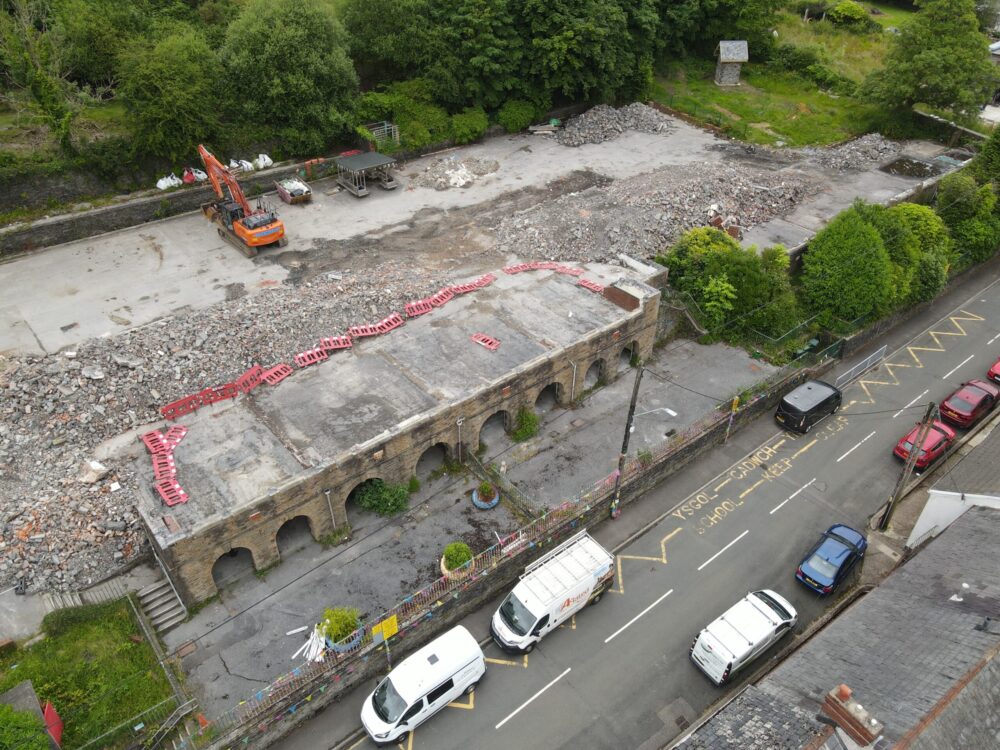
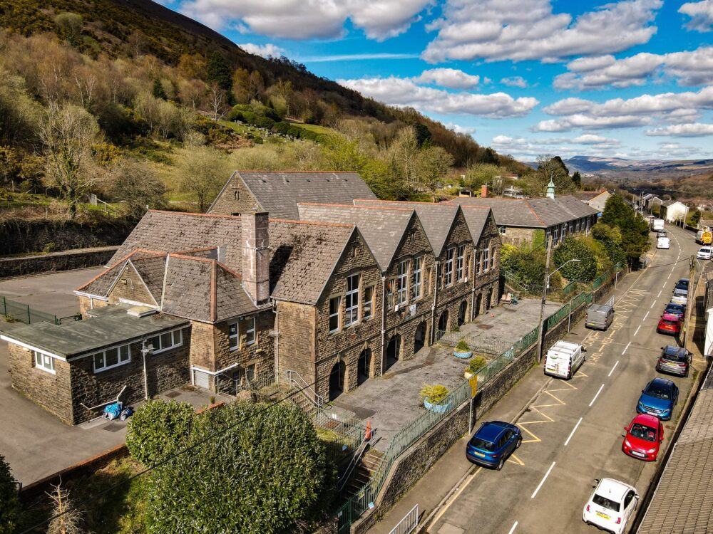
When consultants warned of a possible spoil-tip failure in July 2019, Neath Port Talbot council closed the school overnight. Children were relocated to emergency Portakabins and the historic building was fenced off.
By late 2020 the council announced a new valley-wide ‘superschool’ plan, winning £14.76m in Welsh Government funding. Parents opposed it, fearing the old school would never reopen. Later it was confirmed that the new school wouldn’t be built, leaving pupils in limbo. The rationale behind the school closure was questioned by engineers, who claimed it wasn’t in danger.
The local campaign group Save Our Schools prepared a briefing note for Nation.Cymru which said: “For nearly seven years the closure and eventual demolition of Godre’r Graig Primary School has been justified by reference to spoil deposits and instability above the school.
“What has received far less attention is that two very different official understandings of the site appear to have existed simultaneously.
“One understanding, developed through reports commissioned by Neath Port Talbot Council from Earth Science Partnership (ESP), formed the basis of remediation proposals, closure decisions and ultimately demolition.
“The second emerged through the Welsh Government National Tip Safety Programme and resulted in a substantially smaller, quarry-based definition of the tip.
“The key question is simple: why did these two interpretations differ so significantly, and why did the later National Tip Programme definition appear to have little impact on the decisions that followed?
“In May 2019, consultants Earth Science Partnership (ESP) contacted the Coal Authority on behalf of Neath Port Talbot Council regarding Godre’r Graig School.
“Correspondence shows ESP was already working under significant time pressure and had identified what it described as two coal tips above the school before the Coal Authority inspection took place.
“At the time, the Coal Authority had already been undertaking a wider spoil tip inspection programme for Neath Port Talbot Council.
“The Coal Authority also noted that the work could be arranged more quickly if the council instructed them directly, because an account already existed. This did not happen. Instead, ESP was brought on board and delays followed while administrative arrangements were completed.
“The inspection eventually took place in June 2019. The resulting report is significant for what it says and what it does not say. For Site 2 – the area most closely associated with the later closure decision – the Coal Authority reported that dense vegetation restricted access and visibility and that the extent of spoil could not be accurately determined.
“The report states: ‘The extent of vegetation and ground cover at Site 2 prevented a close inspection of any spoil or surface features in detail … The extent of the spoil could not be proven with accuracy.’
“Despite these limitations, the report included the statement: ‘A major failure of the quarry spoil could potentially reach Godre’r Graig School. Although unlikely.’ This sentence would subsequently become one of the most influential statements in the entire Godre’r Graig story.
“Following the Coal Authority inspection, ESP produced a landslide hazard and risk assessment. Importantly, this was not originally commissioned as a coal tip boundary exercise. The study area extended approximately 400 metres upslope from the school and considered a wide range of landslide hazards.
“The historical evidence cited within the report refers to quarries; spoil mounds; mine adits; and localised deposits associated with quarrying and mining. The report does not identify historical mapping showing a single continuous spoil deposit extending across the entire hillside above the school.
“Nevertheless, ESP subsequently mapped a much larger spoil extent covering a significant area of hillside above the school. This larger interpretation later formed the basis of remediation proposals.
“The remediation study assumed an average spoil depth of approximately five metres across the mapped area and produced an estimated volume of approximately 90,000 cubic metres.
“The obvious question is what evidence demonstrated that the entire mapped area consisted of spoil to that depth?
“Following Storm Dennis in 2020, the Welsh Government established the National Tip Safety Programme.
“The purpose of the programme was not simply to inspect tips, but also to review local authority records; cleanse data; refine boundaries; identify previously unrecorded features; and divide larger historic records into smaller defined units where appropriate.
“The resulting National Tip Programme boundary bears little resemblance to the much larger ESP interpretation. The Coal Authority map records: ‘Only tip material delineated.’ The feature appears largely confined to the former quarry workings and associated deposits.
“The issue is not whether spoil existed above the school. Clearly it did. The issue is not whether instability has occurred elsewhere on Mynydd Allt-y-grug. Historic records show that landslides have occurred in other locations on the mountain. However, the principal landslide feature frequently cited in discussions, TW14/Panteg, is located approximately a mile from Godre’r Graig and is not the hillside immediately above the school.
“The question is therefore much narrower: why did the official National Tip Programme appear to reach a materially different understanding of the tip extent than the one being relied upon locally?
“The most recent development raises perhaps the most significant question of all. Campaigners have obtained evidence suggesting that ESP-derived reports and mapping were only formally submitted to the Welsh Government in October 2025.”
Public domain
An email from a Neath Port Talbot council official to a Welsh Government official dated October 19 2025 said: “In 2020 Earth Science Partnership Consulting Engineers undertook a piece of work on Tip T37552 (L044A). Although it is in the public domain I don’t think we have shared it with WG [the Welsh Government].”
The Save Our Schools briefing states: “This appears to have occurred more than five years after the National Tip Programme commenced; more than four years after the March 2021 boundary review; after David Chadwick MP publicly called for a public inquiry; and after national media attention had intensified.
“This raises an obvious question: why were these documents not incorporated into the National Tip Programme years earlier?”
For the campaigners, the decision to demolish the school remains highly controversial and unconvincing.
Support our Nation today
For the price of a cup of coffee a month you can help us create an independent, not-for-profit, national news service for the people of Wales, by the people of Wales.
Get more trusted Welsh news
Choose Nation.Cymru as a preferred source in Google News to see more of our journalism.


Perhaps both Martin Shipton and David Chadwick MP should have contacted Neath Port Talbot Council to obtain the very detailed technical reports available on the risks to children and staff at the primary school under an unstable hillside with quarry and coal spoil – before publishing this article.