New drone footage reveals ‘significant’ extent of Welsh wildfires
Claire Hayhurst, Press Association
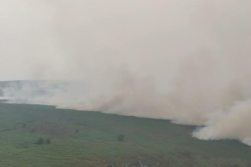
Drone footage has revealed the extent of a significant wildfire in south-east Wales.
Fire crews were initially called to the Blaenavon area, in Torfaen, at 8.42pm on July 19.
By Tuesday morning, the wildfire covered 80 hectares of mixed land of bracken and gorse.
South Wales Fire and Rescue Service said crews had been working in “challenging conditions” because of the terrain, access and wind conditions.
Smoke from the incident is impacting a “large area of south Wales”, the fire service added, with smoke reported as far south as Caerphilly and Cardiff.
Residents and businesses have been advised to keep windows and doors shut.
On Tuesday afternoon, the fire service released footage of the scene taken by drone.
A spokesperson said: “This drone footage of the current wildfire in Blaenavon is now an integral part of our firefighting operation.
“Our specialist drone pilot is able to livestream a bird’s-eye view of the fire to our control room and command suite, which helps inform our strategy and tactics on the incident ground.
“While this technology helps enormously, as a fire service, we still absolutely rely on the courage and professionalism of our crews. Thank you to everyone involved in this team effort.”
Members of the public have been urged to stay away from the area affected by the wildfire.
Support our Nation today
For the price of a cup of coffee a month you can help us create an independent, not-for-profit, national news service for the people of Wales, by the people of Wales.
Get more trusted Welsh news
Choose Nation.Cymru as a preferred source in Google News to see more of our journalism.