Storm Bert disruption continues as full impact of treacherous weather emerges

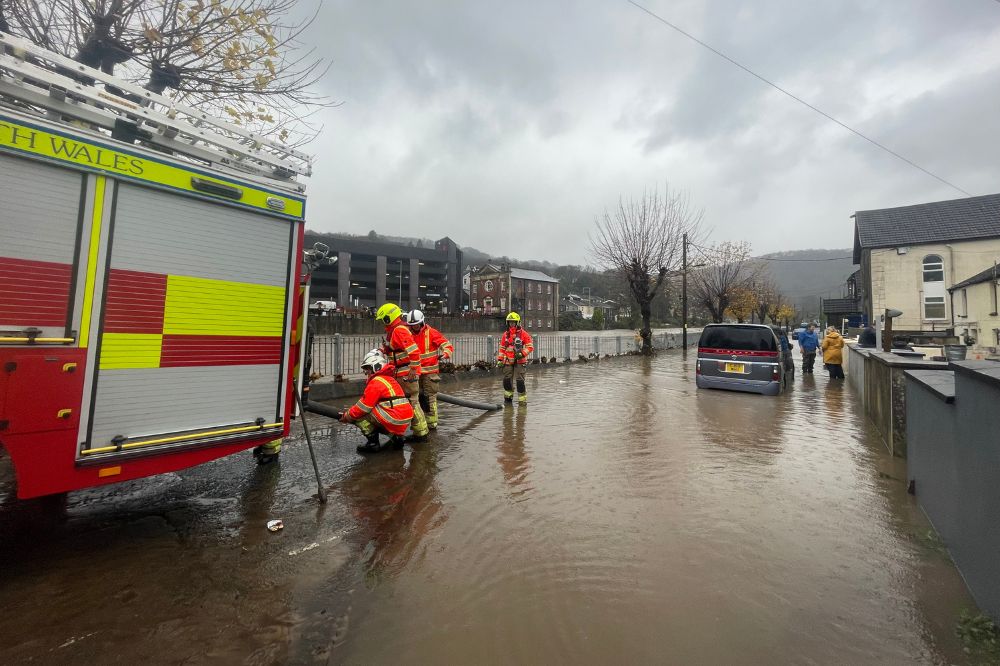
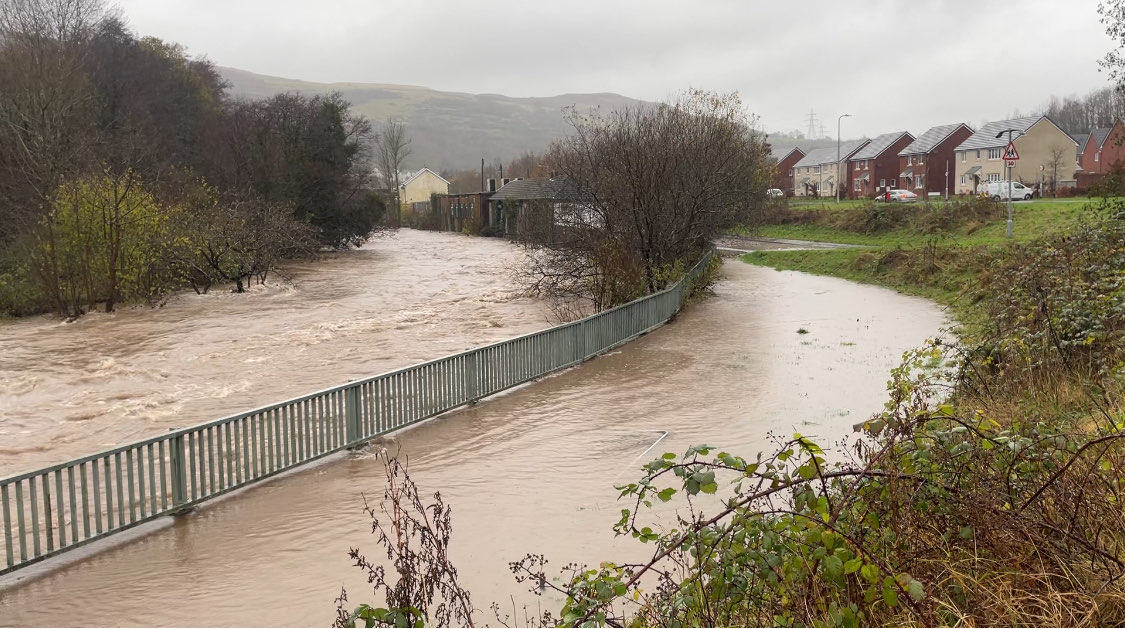
Storm Bert will continue to bring disruption into Monday after torrential downpours caused “devastating” flooding over the weekend.
Hundreds of homes were left underwater, roads were turned into rivers and winds of up to 82mph were recorded across parts of the UK.
The last of the Met Office’s rain warnings ended at 11.59pm on Sunday but strong winds persist and rain from high ground will reach rivers, which could disrupt clean-up efforts.

Warnings
36 flood alerts remain in place for Wales along with 12 flood warnings and travel issues are set to continue into the new week.
Two severe flood warnings, meaning there is danger to life, have been issued for the River Monnow in south-east Wales for Monmouth and Skenfrith.
South Wales will be counting the cost of the storm after a major incident was declared in the Rhondda Cynon Taf region on Sunday amid fears of a more significant impact than during Storm Dennis in 2020.
Between 200 and 300 properties in the area were affected by flooding, with local leaders expressing surprise at the extent of the rainfall.
‘Difficult’
Welsh First Minister Eluned Morgan said it had been “a really difficult weekend”.
At a press conference in Pontypridd on Sunday afternoon, Rhondda Cynon Taf County Borough Council leader Andrew Morgan said he was “amazed” that only a yellow weather warning had been issued by the Met Office.
“On Saturday we were preparing for the possibility of an amber warning,” he said.
“It didn’t come but we took the decision ourselves to step up our resources and have depots open and crews in.
“I am surprised there wasn’t a red warning issued. During Storm Dennis we saw an amber warning in advance and a red warning issued in the early hours. I do think that will need to be reviewed shortly.”
Missing
In north Wales, a body was found in the search for 75-year-old Brian Perry, who went missing while walking his dog during the storm on Saturday near the Afon Conwy river.
Major disruption is expected until 2pm on Monday with some small land slips and trees down on roads across south Wales.
Transport for Wales has warned passengers to check before they travel as some routes will be closed this morning.
- There will be no rail services between Llanhilleth and Ebbw Vale on Monday 25 November, rail replacement services will be in operation.
- Rail services are expected to be severely impacted on the Radyr to Treherbert/Aberdare/Merthyr Tydfil line, with limited rail replacement capacity available.
- The Marches line between Newport to Shrewsbury will be closed until at least midday and rail replacement provision will be extremely limited.
- The Heart of Wales line between Shrewsbury and Llanwrtyd will be closed until at least midday and some roads remain impassable on this route, so rail replacement services are likely to be very limited.
- Lydney to Gloucester, line is currently closed, rail replacement services will be in operation. Services across other rail companies could start later than normal as tracks which were flooded or hit by fallen trees are inspected.
Impact
Great Western Railway says it has suspended services on “all key routes” due to flooding and fallen trees.
The operator’s network runs between London Paddington and both south-west England and south Wales.
It said: “GWR has suspended train services on all key routes after flooding and fallen trees have blocked access at key locations on the Great Western network.
“We’re sorry for the disruption to journeys. Network Rail and GWR teams are working hard across the network and will carry out inspections to reopen lines as quickly as possible.
“Disruption is expected to last until at least the end of the day on Monday.
“Customers are advised not to travel and check for the latest updates and GWR.com.”
Roads
On Sunday night, some major roads were closed due to the ongoing impacts of flooding.
More than 300 flights set to depart from UK airports were cancelled during Storm Bert, aviation analytics firm Cirium said.
Heathrow Airport was worst affected, with crosswinds of up to 40mph causing disruption to departures and arrivals on Sunday.
Simon Brown, services director at the Met Office, said: “Our thoughts are with those who are currently affected with the impacts caused by Storm Bert in south Wales, as well as the rest of the country.
“As always with a named storm, a full assessment of the forecast and warning strategy will take place with our partners.
“But this assessment is carried out post-event, therefore I would expect this to take place over the coming days.
“Storm Bert was well forecast, 48 hours in advance, with a number of warnings in place ahead of the system reaching the UK.
“We work closely with partners to assess the potential risks of extreme weather and the warnings covering Wales highlighted the potential for homes and businesses to flood with fast-flowing or deep floodwater possible, causing a danger to life.”
Showers
On Sunday, large rainfall accumulations were seen, with some places experiencing an excess of 130mm in the last 24 hours.
In some more exposed areas, wind gusts of over 75 miles per hour were experienced.
There will be a cooler start on Monday in Wales with a mixture of sunny spells and blustery scattered showers.
These will be heavy at times, carrying the risk of hail and the odd rumble of thunder possible.
Support our Nation today
For the price of a cup of coffee a month you can help us create an independent, not-for-profit, national news service for the people of Wales, by the people of Wales.


If I were a council, I would not be relying on a single weather source. I don’t now.
But have the met office said why the warnings were low? My app just went to yellow though I didn’t check the risk chart.
Met Eireann had red warnings.