


‘Things could get very tricky’: Wales could see ‘widespread significant snow’ next week
Things could “get very tricky” for Wales next week if expected “widespread” and “significant” snowfall materialises, the BBC’s Derek Brockway has said.
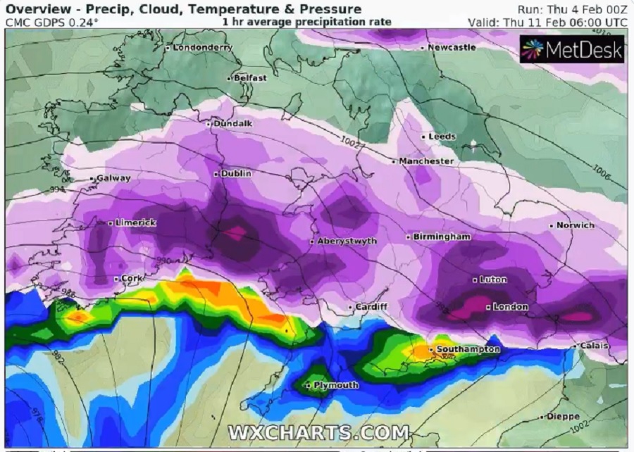
The weatherman, however, emphasised that it was just one possible scenario for next week’s weather. He said the snowfall could potentially happen this time next week, which was too far away to predit with accuracy.
“Don’t take these charts too literally for next Wednesday and Thursday but they do highlight the risk of widespread significant snow if a front moved up from the southwest bumping into cold air,” he said.
“This scenario may not happen but things could get very tricky later next week!”
The Met Office say that over the weekend the very cold air which is currently in place across the north will spread southwestwards across the whole UK.
Snowfall is highly likely, but will mainly be confined to Scotland and the east of England.
The Met Office’s 6-30 day forecast however currently points to the likelihood of cold conditions continuing into mid-February.
Next week will stay chilly with brisk easterly winds making it feel even colder, they said. However, the weather is potentially drier than this week.
Four flood alerts are currently in place for Wales, including the Vyrnwy catchment area, the upper Severn in Powys, south Pembrokeshire and the lower Dee Valley from Llangollen to Trevalyn Meadows.
Support our Nation today
For the price of a cup of coffee a month you can help us create an independent, not-for-profit, national news service for the people of Wales, by the people of Wales.
Get more trusted Welsh news
Choose Nation.Cymru as a preferred source in Google News to see more of our journalism.


