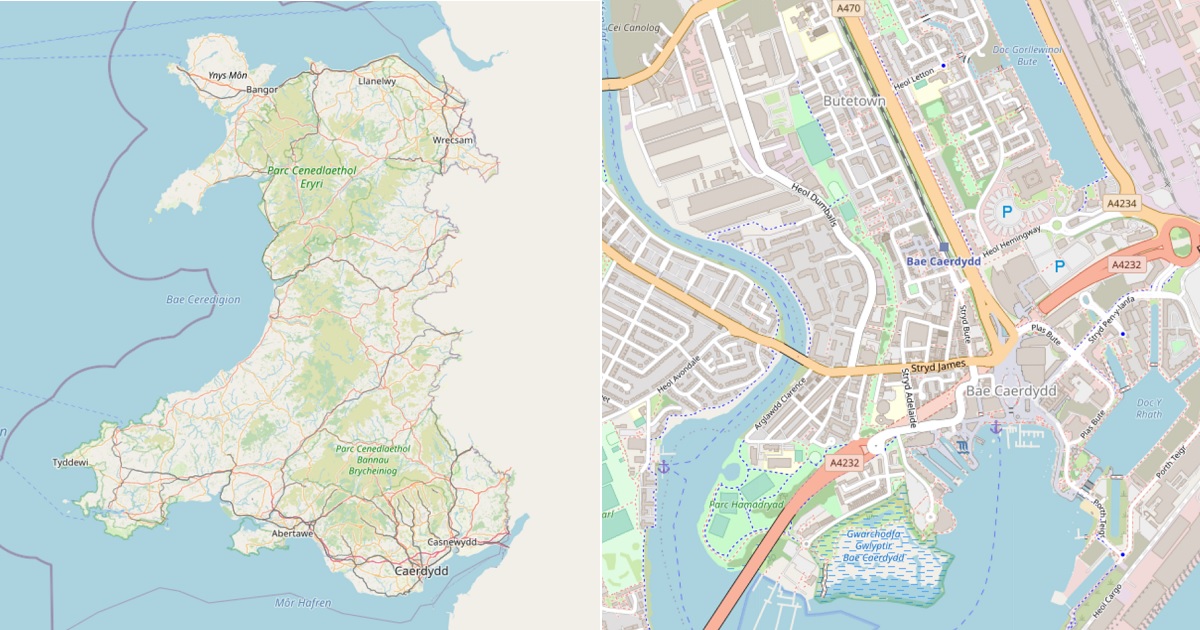
New interactive map lets users visualise Wales entirely in Cymraeg

Users of the Welsh Government’s digital mapping platform will be able to visualise Wales entirely in Cymraeg thanks to a new partnership.
“Data Map Wales” is a Welsh Government service that allows people to search and visualise geographic data about Wales.
This data can be displayed on a choice of digital maps; and now one of these options is to see a map in Welsh.
This service is provided by Mapio Cymru, a project that aims to ensure mapping services are available in Welsh as well as English.
Mapio Cymru has been providing a Welsh-language map of Wales for four years at openstreetmap.cymru but this is the first time they’ve provided Welsh Government with their data.
According to Glyn Jones, Chief Digital Officer for Welsh Government, Mapio Cymru’s work with the new Data Map Wales team “…is a flagship example of what we’re looking to achieve”.
He went on to say: “it’s a really good example of good partnership working, ensuring a bilingual experience for the user”.
Speaking on behalf the Mapio Cymru project Wyn Williams said: “This is an important step towards allowing people to access digital mapping in Welsh as easily as they can in English. We’re delighted to be working with the Data Map Wales team to support their services in Welsh.”
He added: “The Welsh-language map is not as data rich as the English-language maps available from, for example, Ordnance Survey, because of the difficulty of accessing accurate Welsh-language mapping data. Mapio Cymru is working hard to increase the amount of Welsh language mapping data available to all.”
Mapio Cymru is a project hosted by Data Orchard CIC and part-funded by the Welsh Government’s #Cymraeg2050 project that works towards supporting a million regular users of Welsh.
Support our Nation today
For the price of a cup of coffee a month you can help us create an independent, not-for-profit, national news service for the people of Wales, by the people of Wales.


My good friend and former lecturer the late Dafydd Orwig of Dyffryn Ogwen formulated the first fully Welsh Atlas and laid the foundations of this very needed system that will help the nation take ownership of its own mapping system – so long the play thing of OS and cartographers who have changed our local and indigenous names etc
Bore da a diolch am eich erthygl. Should readers want to visit the new Welsh Government Data Map Wales, it can be accessed via this website :
https://datamap.gov.wales/maps/new#/
pob hwyl yn #mapioCymru !