


Wales set to be hit by rain and wind as Hurricane Erin moves across Atlantic
Hurricane Erin is set to move across the Atlantic, bringing wind and rain to the UK.
The major category 3 hurricane is currently north-east of the Bahamas where it has come down from 140mph to 120mph and is expected to bring big waves to the east coast, the Met Office said.
It is forecast to remain out in the ocean, then the remnants of the hurricane could be seen in the UK by late Sunday, meteorologist Marco Petagna said.
There is a risk of rain developing and then the weather is expected to turn increasingly unsettled by the early to middle part of next week.
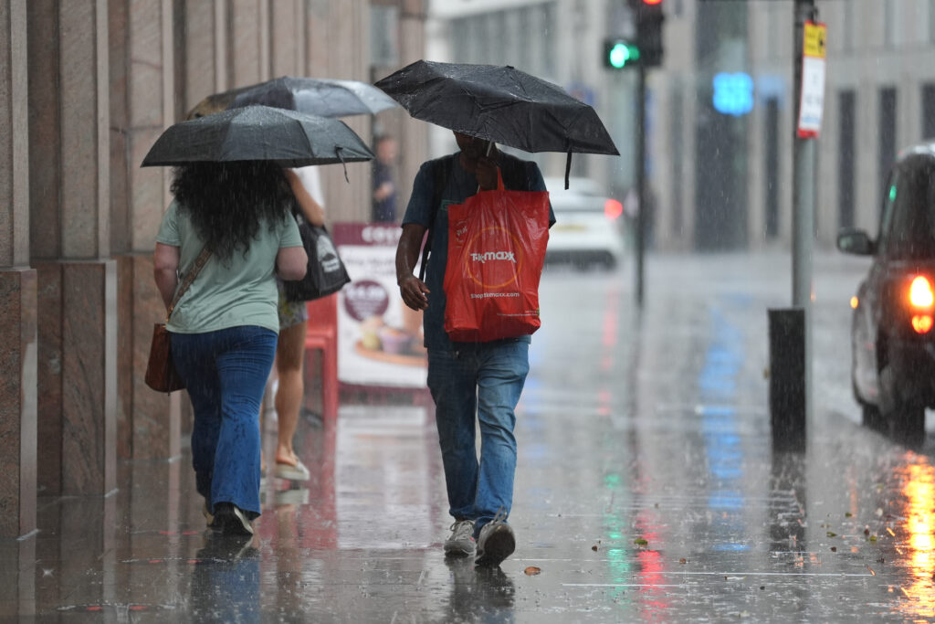
Wet and windy weather could be seen, with heavy downpours at times, and forecasters are monitoring it to decide whether to issue any rain warning nearer to the time, Mr Petagna added.
Record heat
It is set to end a period of dry weather for much of the country, with the UK on track for one of its hottest summers on record.
Mr Petagna said: “Any remnants of the hurricane aren’t expected to have an impact on the UK until early next week, there’s uncertainty how it will play out.
“From late on Sunday the uncertainty starts to kick in.
“There’s a risk of some rain developing, a potential that then things will turn increasingly unsettled.
“It’s likely becoming more unsettled early to middle part of next week, at this stage we can’t be too firm on the details.”
Mr Petagna said wet and windy weather is forecast, and the UK “could well see some heavy rain”.
He added: “We may need some rainfall warnings further down the line, but it’s too early to say.”
In the lead-up to the weekend, inland and western areas will see sunny spells on Tuesday, potentially reaching 25C, while eastern coastal regions will remain cloudy, and light rain or drizzle will move south/south-west across northern and eastern Scotland, later reaching north-east England, the Met Office said.
Above-average temperatures
Wednesday will bring dry weather to the UK and sunny spells will develop widely, with a very low risk of heavy and possibly thundery showers in the far south and south-west early in the day.
Daytime temperatures will be near normal for most areas, although it will feel cool near some North Sea coasts.
It comes after the summer has been marked by persistent warm temperatures even outside the four heatwaves which have hit the country, with June and July both seeing well above-average conditions.
With two weeks to go until the end of the meteorological summer, conditions could still shift, but the season’s overall warmth and consistently above-average temperatures mean it could rank among the UK’s warmest in records dating back to 1884.
Provisional figures from the Met Office show that the UK’s average temperature from June 1 to August 17 stands at 16.2C, some 1.6C above the average temperature.
Support our Nation today
For the price of a cup of coffee a month you can help us create an independent, not-for-profit, national news service for the people of Wales, by the people of Wales.


More weather extremes on its way, be it severe drought conditions or flooding thanks manmade climate change. No doubt Nigel Farage and his Flat Earther cultists in Reform UK, archetypal climate deniers that they are , will call those trying to limit the damage to our planet as, “fear mongering tree hugging wokeism, ” by calling for the reindustrialization of Wales by opening more unsightly dirty opencast coal mines, while advocating drilling in the Antarctic and other sensitive protected areas of outstanding beauty for oil akin to Nero fiddling as Rome burned.
True. And I feel the aggressive senseless way we are going to renewables is actually making us hate renewables as well. Make solar farms, place the tallest wind turbine possible and then the ugliest pylons possible. Why? Solar on rooftops, wind turbines near docks, these areas are ugly anyway, hydroelectric, we have plenty of dams, tidal energy. But these cost and are not efficient enough. So what, this is the sensible approach and into longterm, this will still yield plenty of juice for everyone and keep our countryside pretty for a while till we all get used to the idea… Read more »
OH! NO! It’s going to rain in Wales