


Warnings issued as forecasters warn of heavy rain and possible flooding
Weather warnings have been issued across parts of Wales as forecasters warn of heavy rain, strong winds and a risk of localised flooding over the coming days.
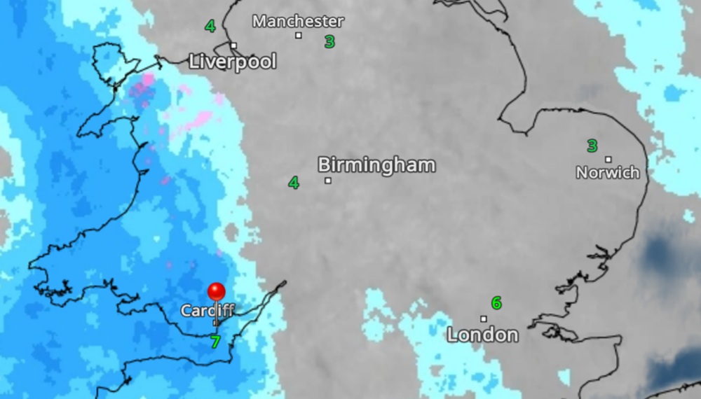
The Met Office has put a yellow weather warning for rain in place covering much of Wales and south-west England from 3pm on Monday until midday on Tuesday.
Forecasters say the unsettled conditions could lead to travel disruption, surface water flooding and some rural communities being temporarily cut off by flooded roads.
Rainfall totals of 20–30mm are expected widely, with significantly higher amounts of between 50–80mm possible over higher ground.
Met Office forecaster Marco Petagna said the most impactful weather would be felt in Wales and the southwest of England.
Natural Resources Wales (NRW) has also issued flood alerts for several river catchments.
In Monmouthshire, flooding of low-lying land and roads is expected along the Rivers Wye and Monnow, with river levels forecast to remain above normal. A separate flood alert is in place for the River Lugg in Powys, where rainfall is already affecting the area.
NRW said it would continue to monitor river levels closely and urged residents in flood-prone areas to remain vigilant.
Mr Petagna said: there could be some “large waves” in some coastal areas covered by the warnings on Monday and Tuesday, with potential for “debris being blown around” and “tiles coming off roofs”.
Despite the unsettled conditions, temperatures are expected to remain close to the seasonal average, though the combination of wind and rain is likely to make it feel colder.
People across Wales are being advised to check travel plans, take care near rivers and coastlines, and stay up to date with the latest weather and flood warnings.
Support our Nation today
For the price of a cup of coffee a month you can help us create an independent, not-for-profit, national news service for the people of Wales, by the people of Wales.


