


Wet and windy weather expected with arrival of Storm Antoni
Heavy rain and strong winds are expected to bring disruption as Storm Antoni hits parts of Wales and the UK on Saturday.
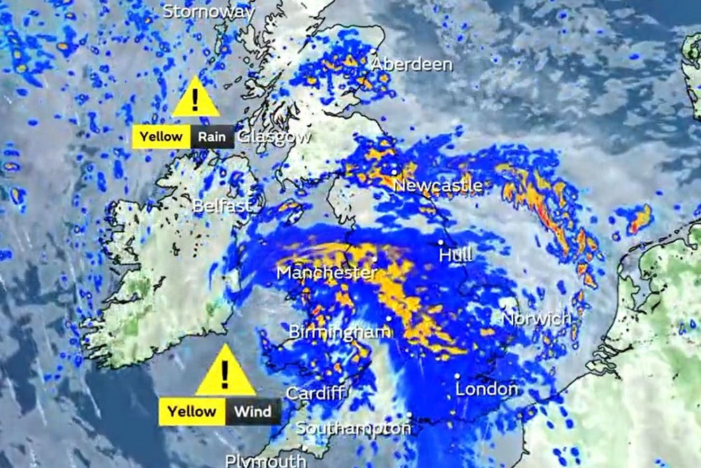
The Met Office has issued an amber warning with the potential for damaging gusts of wind to some southwestern areas of both Wales and England between 11am and 7pm.
That followed a yellow warning for “unseasonably windy weather” to southern parts of the UK between 8am and 8pm.
There is also a yellow warning until 11am for unseasonably wet and windy conditions which may lead to some disruption in Northern Ireland.
An amber warning means there is an increased likelihood of impacts from severe weather and people should consider changing plans and taking action to protect themselves and their property.
Some roads and bridges are likely to close, the Met Office warning says, and “there is a good chance that power cuts may occur, with the potential to affect other services, such as mobile phone coverage”.
Yellow warnings are issued when it is likely that the weather will cause some low level impacts, including some disruption to travel in a few places.
Potentially disruptive
Met Office chief meteorologist Steve Willington said the storm, which is the first to be named by the Met Office this season, will bring “potentially disruptive” weather as it moves from west to east.
He added: “Northern Ireland is likely to see some of the highest rainfall totals, with 40-60mm falling in some spots, but 20-30mm more widely.
“Away from the warning area many will still see a very wet day, especially in north Wales and north England.”
He said that the strongest winds will affect parts of south-west Wales and south-west England, with gusts reaching in excess of 60mph.
“The strongest winds will affect parts south-west England and southwest Wales where exposed coasts and high ground could see gusts in excess of 60mph,” he said.
“In these areas, gusts inland could reach 50-55mph for a time. These windy conditions will likely coincide with high tides which will present an additional challenge for coastal areas.”
‘Atrocious’ conditions
The RAC’s Rod Dennis warned: “We expect Saturday to be the worst day on the roads of the summer so far, especially for anyone in the south-west of England – and that’s a lot of people as our research shows it’s the most popular part of the country for leisure trips by car this year.
“Conditions will be atrocious with a wholly unpleasant mix of very strong winds and locally intense rainfall. The best advice is to slow down significantly to stay safe and avoid exposed moorland and coastal routes until the storm passes.
“Drivers towing caravans and trailers need to be particularly careful in these conditions and those with boxes and bikes on the roof should double-check they’re secured properly.
“Drivers should also watch out for fallen trees and be prepared for the disruption they cause.”
He added that the RAC estimates that around four million cars will be using the roads for leisure journeys across the whole weekend.
Support our Nation today
For the price of a cup of coffee a month you can help us create an independent, not-for-profit, national news service for the people of Wales, by the people of Wales.
Get more trusted Welsh news
Choose Nation.Cymru as a preferred source in Google News to see more of our journalism.


Every cloud has a silver lining: at least we won’t have to put up with patronising articles about how to cope with the Global Boiling Emergency during the Eisteddfod.